Area Overview for LL41 4AF
Photos of LL41 4AF
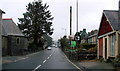
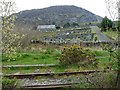
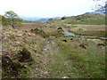
![Former railway line to Bala at Manod [1] in LL41 4AF](https://images.propbar.co.uk/images/geograph/54/03/5403588_120.jpg)

41 photos from this area
Area Information
Key information about the LL41 4AF including its size, population, and administrative classification.
- Area Type
- Postcode
- Area Size
- 7.0 hectares
- Population
- 1856
- Population Density
- 66 people/km²
House Prices in LL41 4AF
57
Properties
£90,959
Average Sold Price
£14,237
Lowest Price
£155,000
Highest Price
Showing 57 properties
| Address | Type | Beds | Baths | Last Sale Price | Last Sale Date | |
|---|---|---|---|---|---|---|
| 84 Ffordd Manod, Manod, Blaenau Ffestiniog, LL41 4AF | Terraced | 3 | 1 | £125,000 | Jul 2025 | |
| 71 Ffordd Manod, Manod, Blaenau Ffestiniog, LL41 4AF | Terraced | 2 | 1 | £105,000 | Jun 2024 | |
| Glan Aber, 94 Ffordd Manod, Manod, Blaenau Ffestiniog, LL41 4AF | house | - | - | £107,500 | Apr 2023 | |
| 88 Ffordd Manod, Manod, Blaenau Ffestiniog, LL41 4AF | Terraced | 3 | 1 | £155,000 | Aug 2022 | |
| 105-106 Ffordd Manod, Manod, Blaenau Ffestiniog, LL41 4AF | house | - | - | £145,000 | Feb 2022 | |
| 67 Ffordd Manod, Manod, Blaenau Ffestiniog, LL41 4AF | house | 4 | - | £155,000 | Feb 2022 | |
| 4 Stad Yr Ysgol, Manod, Blaenau Ffestiniog, LL41 4AF | house | - | - | £123,500 | Sep 2021 | |
| 80 Ffordd Manod, Manod, Blaenau Ffestiniog, LL41 4AF | house | - | - | £106,000 | Aug 2021 | |
| 78 Ffordd Manod, Manod, Blaenau Ffestiniog, LL41 4AF | house | - | - | £80,000 | Jun 2021 | |
| 2 Stad Yr Ysgol, Manod, Blaenau Ffestiniog, LL41 4AF | Semi-detached | 3 | 1 | £125,000 | Jul 2019 |
Page 1 of 6
Energy Efficiency in LL41 4AF
Amenities
Schools
| Rank | School | Type | Entry gender | Ages |
|---|
Explore more schools in this area
Go to Schools tabDemographics
Household Size
One person
most common
Accommodation Type
Houses
most common
Tenure
75
majority
Ethnic Group
White
most common
Religion
N/A
most common
Household Composition
N/A
most common
Age
47
median
Adults (30-64 years)
most common
Household Deprivation
N/A
with no deprivation
NS-SEC
26
in Lower managerial occupations
Explore more demographic insights in this area
Go to Demographics tabPlanning
Planning Constraints
- Flood RiskPremium
- Ramsar Wetland SitesPremium
- Area of Outstanding Natural BeautyPremium
- Protected Nature ReservePremium
- Protected WoodlandPremium
- Crime RiskPremium