Area Overview for LL36 9BY
Photos of LL36 9BY
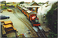

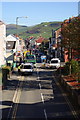
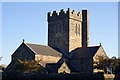
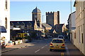

100 photos from this area
Area Information
Key information about the LL36 9BY including its size, population, and administrative classification.
- Area Type
- Postcode
- Area Size
- 4448 m²
- Population
- 1464
- Population Density
- 500 people/km²
House Prices in LL36 9BY
9
Properties
£95,000
Average Sold Price
£95,000
Lowest Price
£95,000
Highest Price
Showing 9 properties
| Address | Type | Beds | Baths | Last Sale Price | Last Sale Date | |
|---|---|---|---|---|---|---|
| Bethany House, College Green, Tywyn, LL36 9BY | Detached | - | - | £95,000 | Jun 2018 | |
| Annexe, Orchard House, College Green, Tywyn, LL36 9BY | Flat | - | - | - | - | |
| Tywyn Silver Band, Office 4, Market Hall, College Green, Tywyn, LL36 9BY | Office | - | - | - | - | |
| Bishton Holdings Ltd, Office 7, Market Hall, College Green, Tywyn, LL36 9BY | Office | - | - | - | - | |
| Office 1, Market Hall, College Green, Tywyn, LL36 9BY | Office | - | - | - | - | |
| Bishton Holdings Ltd, Office 6, Market Hall, College Green, Tywyn, LL36 9BY | retail_financial | - | - | - | - | |
| Canolfan Milfeddygon Cambrian, Cambrian Veterinary Centre, 37 High Street, Tywyn, LL36 9BY | commercial | - | - | - | - | |
| Orchard House, College Green, Tywyn, LL36 9BY | Semi-detached | - | - | - | - | |
| Wilnor Estates Ltd, College Green, Tywyn, LL36 9BY | Office | - | - | - | - |
Energy Efficiency in LL36 9BY
Amenities
Schools
| Rank | School | Type | Entry gender | Ages |
|---|
Explore more schools in this area
Go to Schools tabDemographics
Household Size
One person
most common
Accommodation Type
Houses
most common
Tenure
49
majority
Ethnic Group
White
most common
Religion
N/A
most common
Household Composition
N/A
most common
Age
47
median
Adults (30-64 years)
most common
Household Deprivation
N/A
with no deprivation
NS-SEC
21
in Lower managerial occupations
Explore more demographic insights in this area
Go to Demographics tabPlanning
Planning Constraints
- Flood RiskPremium
- Ramsar Wetland SitesPremium
- Area of Outstanding Natural BeautyPremium
- Protected Nature ReservePremium
- Protected WoodlandPremium
- Crime RiskPremium