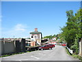
Area Overview for LL33 0ZG
Photos of LL33 0ZG


Area Information
LL33 0ZG is a small residential postcode area in Wales, home to around 1,406 residents. Its compact size means it is a tightly knit community, likely centred on a few key streets or clusters of homes. The area’s demographics suggest a mature population, with a median age of 47 and most residents falling within the 30–64 age range. This hints at a stable, established community, perhaps with families and professionals living in a mix of houses. Daily life here is likely quiet and local, with limited need to travel far for amenities. The absence of major planning constraints like protected woodlands or AONB designations suggests a straightforward environment for living, with no significant restrictions on development. Residents here may value the simplicity of a small area, where familiarity with neighbours and local services is likely. The postcode’s proximity to Bangor and Llanfairpwll railway stations also offers connectivity to larger towns, though the area itself remains focused on its own small-scale character.
- Area Type
- Postcode
- Area Size
- Not available
- Population
- Not available
- Population Density
- Not available
LL33 0ZG has a home ownership rate of 36%, which is relatively low compared to national averages. This suggests that the area is more rental-focused than owner-occupied, though the accommodation type is primarily houses. This combination is uncommon, as house rentals are less typical in smaller areas. The limited population of 1,406 means the housing stock is likely small and tightly held, with few new properties coming on the market. For buyers, this could mean competition for available homes, particularly if the area is seen as a stable or desirable place to live. The presence of houses rather than flats or apartments also indicates a traditional, possibly rural or semi-rural setting, which may appeal to those seeking space and privacy. However, the low home ownership rate implies that the local market may be more sensitive to external factors like interest rates or economic shifts.
House Prices in LL33 0ZG
No properties found in this postcode.
Energy Efficiency in LL33 0ZG
Residents of LL33 0ZG have access to nearby amenities that support daily life. The area is served by two railway stations—Bangor and Llanfairpwll—which connect to major towns and transport networks. For retail, five stores are within practical reach, including Lidl Bangor, Asda Bangor, and Morrisons Bangor. These provide a range of shopping options, from groceries to household goods. While the data does not mention parks or leisure facilities, the absence of protected natural areas suggests that local amenities may be limited to retail and transport. The small size of the area means that residents likely rely on nearby towns for more extensive services, though the existing retail options offer convenience for everyday needs.
Amenities
Schools
The nearest schools to LL33 0ZG include Ysgol Glanadda and Ysgol Ein Harglwyddes, both categorised as 'other' in the data. No Ofsted ratings are provided, so their performance cannot be assessed here. The presence of two schools suggests that families in the area have access to local education options, though the types of schools are not specified. This could mean a mix of state and independent institutions, or schools with specific educational focuses. For parents, the availability of nearby schools is a key consideration, though the exact quality and curriculum of these schools remain unknown. The area’s small size may mean that these schools serve a broader catchment area, potentially drawing students from surrounding postcodes.
| Rank | School | Type | Entry gender | Ages |
|---|
Explore more schools in this area
Go to Schools tabDemographics
The population of LL33 0ZG is predominantly adults aged 30–64, with a median age of 47. This suggests a community that is neither young nor elderly, likely comprising working-age individuals and families. Home ownership rates here are 36%, indicating that a majority of residents rent their homes. The accommodation type is primarily houses, which is unusual for areas with higher rental markets, hinting at a mix of owner-occupied and rented properties. The predominant ethnic group is White, though no specific data on diversity or deprivation is provided. The age profile and housing stock suggest a balanced, stable demographic, with no immediate signs of a transient or rapidly changing population. For buyers, this means a community that is likely to remain consistent over time, with no pressing need for large-scale redevelopment.
Household Size
Accommodation Type
Tenure
Ethnic Group
Religion
Household Composition
Age
Household Deprivation
NS-SEC
Explore more demographic insights in this area
Go to Demographics tabPlanning
Planning Constraints
- Flood RiskPremium
- Ramsar Wetland SitesPremium
- Area of Outstanding Natural BeautyPremium
- Protected Nature ReservePremium
- Protected WoodlandPremium
- Crime RiskPremium