Area Overview for LL23 7AY
Photos of LL23 7AY
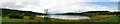
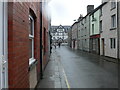
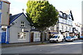
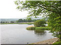
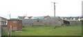
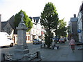
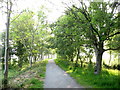
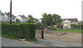
100 photos from this area
Area Information
Key information about the LL23 7AY including its size, population, and administrative classification.
- Area Type
- Postcode
- Area Size
- 1.3 hectares
- Population
- 1992
- Population Density
- 823 people/km²
House Prices in LL23 7AY
25
Properties
£182,250
Average Sold Price
£119,000
Lowest Price
£300,000
Highest Price
Showing 25 properties
| Address | Type | Beds | Baths | Last Sale Price | Last Sale Date | |
|---|---|---|---|---|---|---|
| Llys Gwynedd, 14 Ffordd Y Gerddi, Y Bala, LL23 7AY | house | - | - | £125,000 | May 2021 | |
| Cwm Hirnant, Ffordd Y Gerddi, Y Bala, LL23 7AY | Detached | 5 | 2 | £300,000 | Dec 2019 | |
| Clwydfa, Ffordd Y Gerddi, Y Bala, LL23 7AY | Detached | - | - | £185,000 | Aug 2008 | |
| Rhos Awel, Ffordd Y Gerddi, Y Bala, LL23 7AY | Semi-detached | 3 | 1 | £119,000 | Nov 2003 | |
| Hafan Deg, 10 Ffordd Y Gerddi, Y Bala, LL23 7AY | Bungalow | - | - | - | - | |
| Dros Dro, 3 Ffordd Y Gerddi, Y Bala, LL23 7AY | Bungalow | - | - | - | - | |
| 1 Ffordd Y Gerddi, Y Bala, LL23 7AY | Bungalow | - | - | - | - | |
| Noddfa, 7 Ffordd Y Gerddi, Y Bala, LL23 7AY | Terraced | - | - | - | - | |
| 9 Ffordd Y Gerddi, Y Bala, LL23 7AY | Bungalow | - | - | - | - | |
| 16 Ffordd Y Gerddi, Y Bala, LL23 7AY | Terraced | - | - | - | - |
Page 1 of 3
Energy Efficiency in LL23 7AY
Amenities
Schools
| Rank | School | Type | Entry gender | Ages |
|---|
Explore more schools in this area
Go to Schools tabDemographics
Household Size
One person
most common
Accommodation Type
Houses
most common
Tenure
54
majority
Ethnic Group
White
most common
Religion
N/A
most common
Household Composition
N/A
most common
Age
47
median
Adults (30-64 years)
most common
Household Deprivation
N/A
with no deprivation
NS-SEC
26
in Lower managerial occupations
Explore more demographic insights in this area
Go to Demographics tabPlanning
Planning Constraints
- Flood RiskPremium
- Ramsar Wetland SitesPremium
- Area of Outstanding Natural BeautyPremium
- Protected Nature ReservePremium
- Protected WoodlandPremium
- Crime RiskPremium