Area Overview for Ffestiniog Community
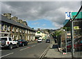
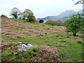
Photos of Ffestiniog Community
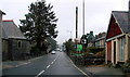
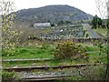
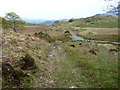
![Former railway line to Bala at Manod [1] in Ffestiniog Community](https://images.propbar.co.uk/images/geograph/54/03/5403588_120.jpg)

Area Information
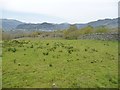
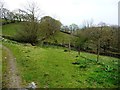
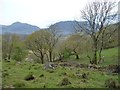
Living in Ffestiniog Community means calling a vast civil parish in north Wales home, covering 57.0 km² of the historic Vale of Ffestiniog. The parish encompasses the principal settlements of Llan Ffestiniog and Blaenau Ffestiniog, situated strategically between the Moelwynion mountains and the break of slope at the valley head. This area has evolved significantly from a medieval farming region to a tourism-focused hub. Today, Blaenau Ffestiniog hosts major attractions like the heritage steam railway and the Llechwedd Slate Caverns, drawing visitors from across the country. While the slate industry once dominated the landscape, the modern community character emphasises cooperation, with a high concentration of social enterprises providing employment and local support. You will find yourself in a setting defined by industrial heritage and dramatic natural beauty, where historic farmhouses survive alongside contemporary community projects. The settlement has a strong local ethos, often characterised by a practical approach to community building that prioritises mutual support over commercial expansion. For those seeking a home near these unique attractions, the parish offers a distinct blend of history and modern social enterprise activity within the Snowdonia region.
- Area Type
- Parish
- Area Size
- 57.0 km²
- Population
- Not available
- Population Density
- Not available
Demographics
The people living in Ffestiniog Community represent one of the older populations in the UK. Data indicates a median age of 70, suggesting a community made up largely of senior residents and retirees. Most common age ranges reflect this demographic shift, meaning you are likely to encounter an accentuated silver population rather than young families or working-age professionals. This age profile often stems from the area's transformation from an industrial centre to a desirable retirement location following the decline of slate quarrying. Home ownership stands at an impressive 69%, confirming that the vast majority of residents live in their own property rather than renting. High ownership rates typically correlate with stability and long-term community engagement, fitting the pattern of an established residential area. While specific data on household composition, predominant ethnic groups, and religious affiliations are not available in current records, the focus on elderly demographics remains clear. This suggests a quiet, established neighbourhood where daily life revolves around established routines and local amenities catering to older adults. When considering homes in Ffestiniog Community, expect to see a market accustomed to owner-occupiers rather than transient families moving in and out frequently.
Household Size
Accommodation Type
Tenure
Ethnic Group
Religion
Household Composition
Age
Household Deprivation
NS-SEC
Explore more demographic insights in this area
Go to Demographics tabPlanning
Planning Constraints
- Flood RiskPremium
- Ramsar Wetland SitesPremium
- Area of Outstanding Natural BeautyPremium
- Protected Nature ReservePremium
- Protected WoodlandPremium
- Crime RiskPremium