Area Overview for Brithdir and Llanfachreth Community
Photos of Brithdir and Llanfachreth Community
Area Information
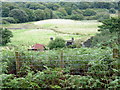
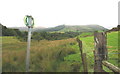
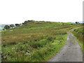
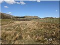
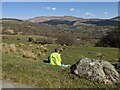
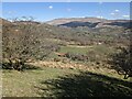
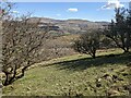
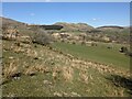
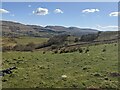
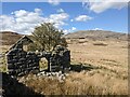
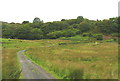
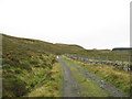
Brithdir and Llanfachreth Community is a civil parish situated in the council area of Gwynedd, within the historic boundaries of Merionethshire. This rural area covers 108.0 km² and sits in the north-west of Wales. The parish includes the village of Llanfachreth, located approximately three miles north-east of Dolgellau. You will find the village perched in the Mawddach valley at the foot of Foel Offrwm and Rhobell Fawr. The location reaches coordinates around 52.785°N 3.848°W. Historical records show the parish emerged from the ancient commote of Talybont in Meirionnydd. Cadwgan founded settlements here around the 12th century, creating 70 tyddynod for arable holdings. Modern life here involves proximity to prehistoric sites like the Iron Age fort at 'Y Gaer' and the Bronze Age cyst at 'Dol y Clochydd'. You can also access the Precipice Walk on Foel Cynwch, which lies south-west of the village. Nearby Glasdir Mine operated as a quarry primarily for copper from c.1852. Living in Brithdir and Llanfachreth Community means inhabiting a landscape shaped by copper mining history and ancient agricultural use. The area also sits close to the 12th-century Cymer Abbey. You are visiting a space where history meets the quiet rhythm of rural Welsh living.
- Area Type
- Parish
- Area Size
- 108.0 km²
- Population
- Not available
- Population Density
- Not available
Demographics
The community inside Brithdir and Llanfachreth has a median age of 70. This indicates a population skewed significantly towards older residents. The most common age group spans the total population range, suggesting a broad distribution of senior citizens rather than a young demographic. House ownership stands at an impressive 81 per cent. You will find that the vast majority of homes in Brithdir and Llanfachreth are in the hands of their owners. This high level of tenure suggests long-term residency and a stable community structure. The data presents household composition and accommodation type totals, but specific breakdowns for these categories are not detailed in the provided information. Similarly, the predominant ethnic group and religious affiliations are not quantified in the available records. You must understand that this is an older, owner-occupied community. The lack of young family households aligns with the high median age. Living here means participating in a society where the primary age group is well-into retirement. Deprivation data is not available in the current dataset, so you cannot directly compare economic hardship levels against other regions. However, the high ownership rate often correlates with lowerRates of rent arrears and greater security for residents.
Household Size
Accommodation Type
Tenure
Ethnic Group
Religion
Household Composition
Age
Household Deprivation
NS-SEC
Explore more demographic insights in this area
Go to Demographics tabPlanning
Planning Constraints
- Flood RiskPremium
- Ramsar Wetland SitesPremium
- Area of Outstanding Natural BeautyPremium
- Protected Nature ReservePremium
- Protected WoodlandPremium
- Crime RiskPremium