Area Overview for Botwnnog Community
Photos of Botwnnog Community
Area Information
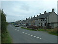
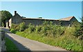
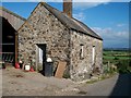
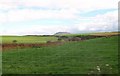
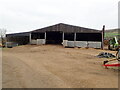
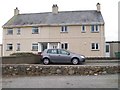
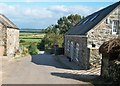
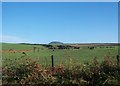
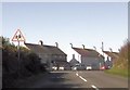
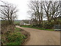
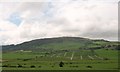
Living in Botwnnog Community offers a distinct experience defined by its isolation and deep cultural roots. This civil parish sits on the Llŷn Peninsula in Gwynedd, covering 34.5 square kilometres between the villages of Mynytho and Sarn Meyllteyrn. You will find yourself in a location that feels closer to Ireland than England, removed from the usual tourist trails. The population has stabilised, growing from 955 residents in 2001 to 996 at the 2011 Census. Daily life revolves around the village itself, which contains a chapel, a doctor's surgery, and a primary school, with most housing comprising a linear strip of properties. The local environment is subtly constrained by its natural settings. Parts of the parish lie within an Area of Outstanding Natural Beauty and contain protected woodlands and nature reserves. There is no railway station or large supermarket within the immediate village boundaries; the nearest shop is located just under two miles away. Instead of a bustling high street, community life often centres on the немногочисленные local businesses that bear distinctly Welsh names. The absence of a pub within the village walls further emphasises the quiet pace of existence here. For those seeking a place where the historic county of Caernarfonshire remains a tangible reality, Botwnnog provides a remote setting where the past and present intersect without the noise of constant development.
- Area Type
- Parish
- Area Size
- 34.5 km²
- Population
- Not available
- Population Density
- Not available
Demographics
The social fabric of Botwnnog Community is defined by an exceptionally high proportion of Welsh speakers and an older resident demographic. Approximately 65 per cent of the remote region speaks Welsh, the highest percentage recorded for any area in Wales. In the village itself, the community website and noticeboards contain no English-language materials, and the school playground resounds with distinctly Welsh speech. This linguistic environment creates a homogenous cultural experience that does not dilute due to tourism. The age profile skews significantly towards the elderly, with a median age of 70 years. Most households fall into the total age category, suggesting a population without sharp generational divides. Home ownership stands at 68 per cent, indicating a stable group of residents who call this parish their long-term home. Accommodation types reflect this stability, with many properties serving as permanent residences rather than holiday lets. The village consists primarily of council properties alongside private homes, many of which are clustered in a strip of houses. With no specific ethnic group data provided in the available records, the community appears culturally unified through its language and history. This demographic profile points to a quiet settlement where fewer young families or transient populations might be seen, favouring a slower, more traditional rhythm of life.
Household Size
Accommodation Type
Tenure
Ethnic Group
Religion
Household Composition
Age
Household Deprivation
NS-SEC
Explore more demographic insights in this area
Go to Demographics tabPlanning
Planning Constraints
- Flood RiskPremium
- Ramsar Wetland SitesPremium
- Area of Outstanding Natural BeautyPremium
- Protected Nature ReservePremium
- Protected WoodlandPremium
- Crime RiskPremium