Area Overview for Bontnewydd Community
Photos of Bontnewydd Community


Area Information
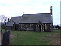
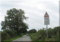
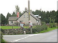
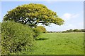
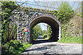
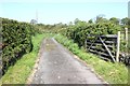
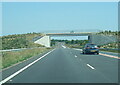
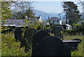
Living in Bontnewydd Community offers a distinct character within the gwynedd region of north-west wales. You find yourself in a small village and civil parish covering an area of 10.7 km², situated on the A487 road just 1⅔ miles south of Caernarfon. The village name, which standardises to Y Bontnewydd meaning 'new bridge', reflects its history as a transport hub facilitating access across the Afon Gwyrfai. Daily life here moves at a measured pace, yet connectivity remains strong via Bontnewydd railway station, an unstaffed halt on the Welsh Highland Railway. The community includes the hamlet of Llanfaglan and functions as a single electoral ward on Gwynedd Council since 1995. You are located close to the River Gwyrfai and only 2 miles from its outflow into Foryd Bay. The area blends natural history with modern settlement, having been built upon sites with Bronze Age burnt mounds and Roman roads linking Caernarfon and Caerhun. For those considering homes in Bontnewydd Community, you gain access to historic landmarks like Plas Dinas and Gypsy Wood Park, as well as essential amenities including a small supermarket and the Newborough Arms pub. The parish has developed alongside significant infrastructure projects, such as recent bypass works that revealed further archaeological discoveries.
- Area Type
- Parish
- Area Size
- 10.7 km²
- Population
- Not available
- Population Density
- Not available
Demographics
The population of Bontnewydd Community stands at 1,162 residents, creating a tight-knit environment. You will find the demographic profile leans heavily towards older age groups, with a median age of 70 years old. This figure indicates a settlement where retirees and long-term residents form the core of the neighbourhood rather than young families or students. Home ownership proves to be the dominant tenure model, with 79 per cent of households in Bontnewydd Community owned outright or with a mortgage. This high level of ownership suggests stability within the streets and a lack of transient rental populations. The data describes the total household composition and total accommodation type without specifying minority breakdowns, though the predominant ethnic group and religious affiliation are listed as total figures in the dataset. The age structure implies a community accustomed to lower energy demands and potentially different social rhythms compared to younger urban centres. You learn that the area does not cater primarily to a youthful demographic, which influences the types of local services required. The concentration of older residents often correlates with specific healthcare needs or leisure activities suited to that age bracket. Living in this parish means participating in a community defined by longevity rather than rapid demographic turnover.
Household Size
Accommodation Type
Tenure
Ethnic Group
Religion
Household Composition
Age
Household Deprivation
NS-SEC
Explore more demographic insights in this area
Go to Demographics tabPlanning
Planning Constraints
- Flood RiskPremium
- Ramsar Wetland SitesPremium
- Area of Outstanding Natural BeautyPremium
- Protected Nature ReservePremium
- Protected WoodlandPremium
- Crime RiskPremium