Area Overview for Bala Community
Photos of Bala Community
Area Information
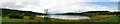
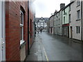
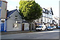
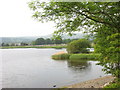
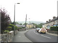
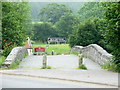
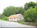
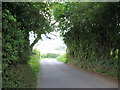
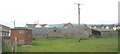
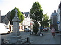
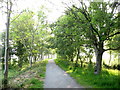
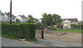
Bala Community is a compact civil parish in Wales covering an area of 2.6 square kilometres. Living in Bala Community means navigating a small, tightly defined neighbourhood where local life moves at a distinct pace. The parish offers a singular character without the sprawl found in larger districts. Its size dictates that daily amenities and interaction are central to the routine of residents who call this area home. You will find a settlement where boundaries are clear and the community footprint is manageable. This context shapes the experience of moving to Bala Community, emphasising proximity and intimacy over urban convenience. The scale of the parish ensures that many services rely on the wider Bala area, yet the core identity of the community remains self-contained within these specific limits. For anyone considering homes in Bala Community, the environment presents a specific type of rural living. The population density is naturally low due to the limited land available. This setup suits those seeking a quiet retreat while still being situated within the historic Cambrian Mountains region. The area functions as a distinct village unit within the larger administrative structure of Gwynedd. Your time here will be defined by the local geography and the tightly knit nature of the neighbourhood. Understanding these geographic constraints helps you visualise what life in Bala Community actually entails. The parish serves as a focal point for local life, balancing isolation with community cohesion in a very traditional Welsh setting.
- Area Type
- Parish
- Area Size
- 2.6 km²
- Population
- Not available
- Population Density
- Not available
Demographics
The demographic profile of Bala Community reveals a community with a notably older population. The median age stands at 70 years, indicating that the majority of residents are senior citizens. You are likely to encounter an area where family life centres on retirement or late-middle-aged retirement rather than young households. This age distribution suggests a quiet residential environment with particular demands on healthcare and leisure facilities suitable for older people. While the specific breakdown of most common age ranges is listed as total in available records, the median age firmly establishes the senior demographic as the core of the community. Home ownership plays a significant role in how residents interact with their properties. Approximately 54% of households in Bala Community own their homes outright or with a mortgage. This majority ownership rate points to an established community where residents have a long-term stake in the local area. The remaining households fall into the rented sector, contributing to a stable mix of housing tenure. Accommodation type data is recorded as total, confirming the existence of diverse housing stock, though specific apartment versus detached villa splits are not provided. Despite the absence of detailed ethnicity or religion statistics in the current dataset, the area clearly functions as a homogeneous community defined by its ageing population. This demographic reality shapes the local economy, with services and social clubs likely catering primarily to a mature resident base.
Household Size
Accommodation Type
Tenure
Ethnic Group
Religion
Household Composition
Age
Household Deprivation
NS-SEC
Explore more demographic insights in this area
Go to Demographics tabPlanning
Planning Constraints
- Flood RiskPremium
- Ramsar Wetland SitesPremium
- Area of Outstanding Natural BeautyPremium
- Protected Nature ReservePremium
- Protected WoodlandPremium
- Crime RiskPremium