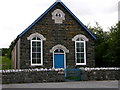
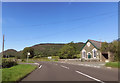
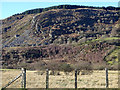
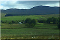
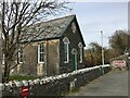
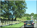
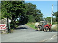
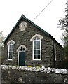
Area Overview for Llanuwchllyn Community
Photos of Llanuwchllyn Community
Area Information
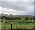
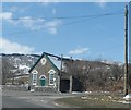
Living in Llanuwchllyn Community offers a distinct experience within the Welsh landscape. This unitary electoral division covers an expansive area of 117.2 km², providing ample space for those seeking room to breathe. The location sits firmly in Wales, far removed from the urban density found near major capital cities. Daily life here revolves around a vast, rural setting where the terrain dictates movement more than paved roads do. You will find that distances matter significantly in this region, as the generous land area means amenities are rarely within immediate walking distance. The character of Llanuwchllyn Community is defined by its isolation and natural surroundings. Pitching a tent or setting up home here means embracing a lifestyle where the outdoors takes precedence. The sheer size of the area allows for significant privacy and quiet, which appeals to residents who value seclusion over proximity to city centres. However, this vastness also implies that navigation requires careful planning. You should be prepared for a driving-centric routine if you wish to access services or connect with other communities. The area's identity is inextricably linked to its geography. Prospective homeowners looking at Llanuwchllyn Community must accept that trade-off between serene landscape and connectivity.
- Area Type
- Parish
- Area Size
- 117.2 km²
- Population
- Not available
- Population Density
- Not available
Demographics
The population profile within Llanuwchllyn Community shows a clear shift towards an older demographic. The median age stands at 70 years, indicating that roughly half the population is older than this threshold. This statistical reality suggests a community dominated by retirees rather than a mix of young families and professionals. With the most common age range recorded as "Total", the data reflects an exceptionally mature household composition across the entire area. Home ownership defines the social fabric of Llanuwchllyn Community, with 79% of residents owning their properties outright. This high proportion signals a long-term settlement pattern rather than a transient commuter community. You are unlikely to meet many tenants in walkways or community centres, as the vast majority hold title deeds to their dwellings. This level of tenure stability often correlates with ties to the local area spanning several decades. Accommodation type, predominant ethnic group, religion, and deprivation data are not currently available for this specific region. While this limits a comprehensive sociological profile, the quantitative evidence regarding age and ownership remains robust. The concentration of elderly owners paints a picture of a traditional rural community. Small settlements in rural Wales frequently exhibit this demographic skew. The statistical data confirms that Llanuwchllyn Community functions as a retirement haven rather than a hub for young families or diverse economic groups.
Household Size
Accommodation Type
Tenure
Ethnic Group
Religion
Household Composition
Age
Household Deprivation
NS-SEC
Explore more demographic insights in this area
Go to Demographics tabPlanning
Planning Constraints
- Flood RiskPremium
- Ramsar Wetland SitesPremium
- Area of Outstanding Natural BeautyPremium
- Protected Nature ReservePremium
- Protected WoodlandPremium
- Crime RiskPremium