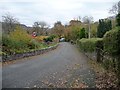
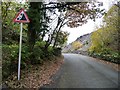
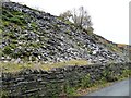
Area Overview for Llanllyfni Community
Photos of Llanllyfni Community

Area Information
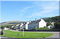
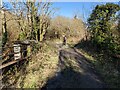
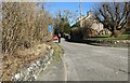
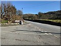
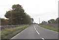
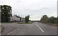
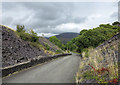
Living in Llanllyfni Community offers a distinct experience within the civil parish of this forty-two point eight square kilometre area in Wales. This settlement is defined by its rural character, yet it provides a solid foundation for daily life with reliable digital infrastructure. The landscape here is notably free from major planning constraints, as there are no Ramsar wetland sites or Areas of Outstanding Natural Beauty covering the land. While the area does contain protected nature reserves and woodland, these designations do not hinder development in a way that typical planning restrictions might. You will find that homes in this parish sit in a setting where financial commitment to housing is the norm rather than the exception. The community operates without the burden of criminal statistics, as official crime data currently applies only to England. Instead, your focus shifts to environmental stability, where flood risks are minimal and scores indicate a safe living environment. The size of the parish means you are far enough from urban centres to enjoy a quiet retreat, yet close enough to access essential services. Prospective buyers appreciate that the area maintains a high standard of fixed broadband, ensuring connectivity remains robust regardless of seasonal weather changes. This balance of natural space and modern utility defines the character of life here.
- Area Type
- Parish
- Area Size
- 42.8 km²
- Population
- Not available
- Population Density
- Not available
Demographics
The population profile within Llanllyfni Community tells a clear story of a mature settlement where a median age of seventy years defines the typical resident. You are looking at an area where the most common age classification is simply listed as Total, indicating a broad demographic spread, but the central tendency leans heavily towards older residents. This age profile suggests a neighbourhood built for those seeking a slower pace of life without the energy demands of younger families or transient workers. Financially, the community reflects a strong tradition of homeownership, with sixty-nine per cent of households owning their dwellings outright. This figure signals a stable market where properties tend to stay within families for generations rather than circulating through the rental sector. The remaining thirty-one per cent of households represent long-term tenants, further reinforcing the idea that turnover is low and social networks are deep-rooted. You will not find rapid shifts in the makeup of the population here. Diversity data regarding predominant ethnic groups and accommodation types is not numerically specified in current records, yet the high ownership rate implies a settled population. For those considering schools near this parish, the underlying demographic suggests a need for educational facilities catering to younger cohorts moving in, while existing churches and community halls likely serve a mostly elderly congregation. Living in Llanllyfni Community means joining a demographic that values property investment and local stability above rapid growth or youthful vibrancy.
Household Size
Accommodation Type
Tenure
Ethnic Group
Religion
Household Composition
Age
Household Deprivation
NS-SEC
Explore more demographic insights in this area
Go to Demographics tabPlanning
Planning Constraints
- Flood RiskPremium
- Ramsar Wetland SitesPremium
- Area of Outstanding Natural BeautyPremium
- Protected Nature ReservePremium
- Protected WoodlandPremium
- Crime RiskPremium