Area Overview for Llandderfel Community
Photos of Llandderfel Community
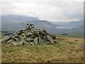
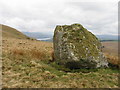
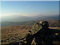
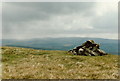
Area Information
Living in Llandderfel Community offers a distinct lifestyle defined by its rural character and extensive green space. This civil parish spans 115.5 square kilometres, providing a vast area for residents to enjoy nature while maintaining a connection to Welsh heritage. The community attracts those seeking a quieter pace of life away from urban centres, yet remains accessible to the wider region. Daily life here revolves around the natural environment, which dominates the landscape given the significant coverage of protected areas. You will find that life in Llandderfel Community balances isolation with local amenities suited to smaller population needs. The geography supports outdoor activities, making it a logical choice for individuals who prioritise access to open land over urban density. While the town centre may feel small compared to larger settlements, the surrounding countryside compensates with freedom and tranquillity. Prospective residents often appreciate the sense of ownership that comes with living on such a large tract of land where boundaries stretch far beyond the immediate village limits. The area functions as a self-contained parish where residents rely heavily on local services created within its boundaries. Transport links connect you to nearby towns, but you should expect to travel for major retail or medical appointments. This layout suits families with older children or retirees who value spacious living over rapid transit. Understanding the scale of 115.5 square kilometres helps you realise that your backyard essentially extends into the rolling hills and farmland that define the parish.
- Area Type
- Parish
- Area Size
- 115.5 km²
- Population
- Not available
- Population Density
- Not available
Demographics
The demographic profile of Llandderfel Community reveals a settled and mature population. The median age stands at 70 years, indicating that the majority of residents belong to older age groups. This statistic reflects a community where many families have raised their children and now reside in the area permanently, often accompanying their aging parents or choosing retirement living. You will observe a household composition that mirrors this older average, with fewer young families compared to urban districts. Home ownership remains the dominant form of tenure at 67 per cent, creating a financially stable and rooted community. This high rate of homeownership suggests that many residents have built equity over decades rather than renting temporarily. Consequently, you will find a housing stock that includes many long-standing properties passed down through generations or renovated for modern comfort by existing owners. The social fabric appears tight, with neighbours likely knowing each other due to the stability provided by this tenure model. Diversity in ethnicity and religious affiliation exists within Llandderfel Community, though specific breakdowns are not detailed in current records. The overall age distribution is broad when looking at the total population, meaning you will encounter a range of life stages despite the high median age. This mix can be beneficial for intergenerational projects or local volunteering schemes. When evaluating homes in Llandderfel Community, you can expect an environment where privacy and quiet are valued alongside community cohesion. The low percentage of private rentals supports the idea that living here is typically a long-term commitment.
Household Size
Accommodation Type
Tenure
Ethnic Group
Religion
Household Composition
Age
Household Deprivation
NS-SEC
Explore more demographic insights in this area
Go to Demographics tabPlanning
Planning Constraints
- Flood RiskPremium
- Ramsar Wetland SitesPremium
- Area of Outstanding Natural BeautyPremium
- Protected Nature ReservePremium
- Protected WoodlandPremium
- Crime RiskPremium