Area Overview for Llanberis Community
Photos of Llanberis Community


Area Information
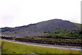
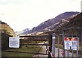
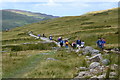
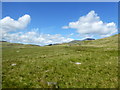
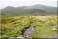
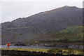
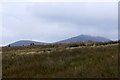
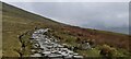
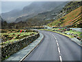
Living in Llanberis Community offers a distinct experience within the civil parish of this part of Wales. The area covers 46.2 km², providing a substantial footprint that combines rural tranquillity with the historical significance of its location. This is not a typical urban suburb; it is a parish defined by its landscape and slower pace of life. You will find that daily routines here revolve around local amenities and the wider natural surroundings rather than the immediate hustle of large cities. The character of Llanberis Community is shaped by those who call it home, creating an environment where space and scenery take precedence over high-density development. Prospective buyers should understand that the area has a specific demographic profile that influences its atmosphere. The community is not rapidly expanding with young families seeking city edge residential zones. Instead, it maintains a stable identity rooted in long-term residents. When you walk through the streets, you encounter a settlement that prioritises conservation and established patterns of living. The size of the parish ensures that amenities are spread out, meaning travel times for shopping or services are part of the daily rhythm. You are opting for a life where the 46.2 km² of land offers a balance between seclusion and access to regional transport links. This parish stands separate from the more commercialised tourist clusters often associated with the Snowdonia region. While Llanberis is a gateway to mountains, the residential experience in the community itself focuses on established neighbourhoods. You will notice that the layout supports a quiet lifestyle, away from the constant foot traffic seen in larger towns. The area functions as a self-contained entity where residents manage their lives with a degree of independence from metropolitan centres. Choosing homes in Llanberis Community means accepting a setting where nature dictates the boundaries of development. It is important to view Llanberis Community realistically. The parish provides a complete living environment, but you must engage with the specific constraints and advantages that define this land. The 46.2 km² expanse includes variations in elevation and terrain that affect how you move through the area. You will find that the community feels manageable, yet vast enough to offer privacy. The civil parish status adds a layer of local governance and distinct identity that sets it apart from neighbouring villages. Your decision to live here relies on an acceptance of these geographical realities. The settlement is a place where history meets modern living, though the latter is tempered by the rural context. You do not find the towering apartment blocks common in coastal towns. Instead, the housing reflects the modest scale appropriate for a parish of this size. The community relies on its established infrastructure rather than relying on new large-scale construction projects. This approach preserves the visual character of the landscape while providing for those who choose this way of life. Llanberis Community remains a coherent unit of habitation where the focus is on continuity. When you consider homes in Llanberis Community, you are entering an area with defined limits and clear purposes. The parish administration manages a territory that respects the constraints of the wider countryside. Residents appreciate the lack of urban sprawl that often plagues more populated regions of Wales. You gain a sense of place that is tangible and grounded in the specific geography of the parish. The 46.2 km² area ensures that every square kilometre carries weight in the overall character of the settlement. You cannot simply expand the town limits; the community exists within these fixed boundaries. Living here requires an active engagement with the local environment. The parish provides a backdrop of hills and valleys that frames every view. You will find that the area is defined by what is left intact rather than what has been added. This conservation-minded approach benefits those who value a natural setting. The civil parish structure supports this stewardship of the land. You can expect a consistent visual standard that protects the aesthetic quality of the neighbourhood. Llanberis Community offers a proven model of rural living that continues to function effectively. The community does not promise rapid growth or new leisure developments. It offers a stable environment where existing residents define the culture. You join a group that values the established landscape of the parish. The 46.2 km² area is large enough to feel spacious yet small enough to remain cohesive. This balance is key to the appeal of Llanberis Community. You find a place where the focus remains on residents and their immediate surroundings. The parish provides a clear sense of identity that you can rely on. Ultimately, Llanberis Community is a choice for those who prefer a specific type of rural existence. The data confirms a population that has settled into this pattern of living. You will find a homebase that supports traditional activities and local governance. The parish remains a functional and defined unit within Wales. Your life here will follow the rhythms set by the local time and travel distances. The 46.2 km² area serves as a charm and a challenge in equal measure. You gain a territory where the rules of density do not apply. Llanberis Community stands as a testament to embedded rural living. It is a reality that you must accept when you decide to move. The parish offers what it has always offered. You will find a community that expects you to engage with its constraints. The 46.2 km² provides a canvas for a quiet life. Llanberis Community is a parish where the past frames the future. You live in a place where history is part of the daily experience. The homes here reflect the long-standing presence of the population. This is a settled area where change comes slowly. Llanberis Community remains a distinctive part of the Welsh landscape. You should approach your move with a clear understanding of what you are buying. The parish offers a specific lifestyle that matches a specific demographic. The 46.2 km² area supports this demographic by providing space and shelter. Llanberis Community is a place where you live as part of a long tradition. The civil parish boundaries define the scope of your environment. You find a neighbourhood that works because it has been allowed to work for so long. The area size contributes to the feeling of being away from the rush. Llanberis Community is a home for those who understand its value. The community offers a sense of belonging that comes with time. You will find residents who have lived here for generations or settled into a permanent role. The 46.2 km² parish contains the necessary infrastructure for this stability. Homes in Llanberis Community are designed for those who seek consistency. You will notice the lack of transient development in the area. The parish council manages a territory that prioritises the existing residents. This focus creates a peaceful and predictable environment for your family. Llanberis Community delivers on the promise of a stable rural life. It is a place where you can settle down without the pressure of rapid change. The area size ensures that there is room for mature growth. You will find a parish that respects its limits. Llanberis Community is a location where you live alongside the natural features of the land. The civil parish status reinforces the importance of local management. You can expect a neighbourhood where decisions are made with the long term in mind. The homes support a lifestyle that values the local environment. This is a community for those who want a life defined by place. Llanberis Community is a choice for the discerning homebuyer. The parish provides a clear identity that you can claim as your own. You will find a settlement that does not seek to overpower its surroundings. The 46.2 km² area protects this balance. Llanberis Community is a place where you live with an awareness of the land. The civil parish framework supports this relationship between people and place. You gain a sense of ownership over your environment that city living cannot offer. The homes are situated in a way that respects the local topography. This is a community where the landscape matters. Llanberis Community is a home for those who already get it. You will find that the area offers a complete package for rural living. The parish provides the setting, the infrastructure, and the identity. The 46.2 km² size is a key factor in this offer. Llanberis Community is a place where you live in a manner that suits your needs. The civil parish boundaries ensure that the area remains distinct. You find a neighbourhood that you can call your own. The homes here are built for those who appreciate the local way of life. This is a community that stands on its own merits. Llanberis Community is a location that delivers what it promises. The community offers a final word of truth about its nature. You will find a parish that is honest about its limits. The 46.2 km² area is all there is. Llanberis Community is a place where you live with a clear view of reality. The civil parish status confirms the local governance of the area. You find a settlement that does not hide its character. The homes are designed for those who want a straightforward life. This is a community that you can understand and trust. Llanberis Community is a home for those who value clarity.
- Area Type
- Parish
- Area Size
- 46.2 km²
- Population
- Not available
- Population Density
- Not available
Demographics
The community in Llanberis Community is defined by a significant shift in age demographics. The median age for residents is 70, which places this area well above the national average for similar rural settlements. You should expect to find that the population consists largely of older individuals, reflecting the long-standing residential nature of the parish. This age profile means that the social scene and local services cater to the needs of an elderly population. Homes in Llanberis Community appeal to those seeking retirement or semi-retirement living rather than bringing up young families. The lack of young age ranges indicates a slow turnover of residents. You will notice that the household composition in Llanberis Community mirrors the older resident base. The data currently does not break down specific household types beyond a general total, suggesting a variety of living arrangements typical of a mature community. However, the high proportion of older residents implies that many households consist of couples living together or single occupants. You will find that the cultural fabric of the parish is shaped by these established families and individuals. The area does not experience the rapid population shifts seen in tourist hubs. Home ownership presents a clear picture of the financial status of the community. A remarkable 67% of properties in Llanberis Community are owner-occupied. This figure stands in stark contrast to rental-heavy urban areas where investors dominate the market. You will find that the majority of residents have purchased their homes over a long period. This level of ownership creates a stable community where people have a deep stake in the local area. The high ownership rate suggests that residents are likely to stay put, fostering strong local networks. You do not encounter the high turnover typical of the buy-to-let market. The accommodation type data is limited in our current statistics, but the 67% ownership figure strongly suggests a stock dominated by traditional houses rather than purpose-built rental blocks. This aligns with the area's status as a long-settled parish. You will find that the housing stock reflects a gradual evolution over decades. The absence of large blocks of flats supports the smaller scale of the community. You are looking at an area where residents own the homes they live in. This stability is a key feature of life in Llanberis Community. Ethnic diversity and religious data are not provided in the current parameters for this parish. Instead, the focus here is on the age and ownership profile which are substantial facts. You will find that the community is quite homogeneous in age, which influences the local culture. The residents share a common demographic experience that shapes their interactions. This lack of youth brings a specific calmness to the parish. You find a community where the pace of life is dictated by an older generation. Deprivation data is not explicitly available, but the high home ownership and older age profile offer clues about the quality of life. Residents likely benefit from security of tenure and established housing. You will find that the 67% ownership rate reduces the financial stress common among tenants. The area does not suffer from the volatility of the rental market. You can expect a steady environment where residents are invested in their homes. Llanberis Community offers a life defined by stability and long-term ownership. When you consider the social implications of the age profile, you see a community built on longevity. The median age of 70 means that the primary demographic is settled. You will find that local events and spaces accommodate this demographic. The area functions well for those in later life stages. Homes in Llanberis Community are suited to this population. You do not find the amenities clustered for toddlers or teenagers. Instead, the infrastructure supports the established residents. This is a community that honours its older inhabitants. The 67% home ownership rate is a robust statistic that defines the area. You can rest assured that most people live here as owners. This reduces the transient nature of the population. You will find a stable neighbourhood where faces are familiar. The community relies on this foundation of ownership. It is this fact that makes Llanberis Community distinct. You are buying into an area of stability and known residents. The demographic profile is clear and supportive. You will find that the community is a mature environment. The residents have built a society that functions for themselves. The median age of 70 is the central fact you must know. It explains the layout and availability of local services. You will find that the area is not designed for booming growth. It is designed for steady, existing populations. Homes in Llanberis Community reflect this steady state. You live in a place where the population is constant. This is a community for those who value this certainty. The demographic data provides a clear factual basis for your decision. You see a high level of ownership and an older population. These are concrete facts about Llanberis Community. You will find that the area suits your needs if you value stability. The 67% ownership figure is a strong indicator of this. You can expect a low churn of residents. The community remains the same year after year. This consistency is rare and valuable. Llanberis Community offers a snapshot of a living community. You should note that the age profile is very specific. The median age is 70 and does not waver. This means the community does not seek to attract young families. You will find a peaceful environment suited to retirement. The homes here support this specific population. You do not find the noise or activity of mixed-age zones. Llanberis Community is for those who want quiet. The data proves that this is a mature parish. You can trust these figures to guide your expectations. The community in Llanberis Community is defined by these numbers. You see a clear picture of an older, owner-occupied area. This is a fact-based reality of the parish. You will find a place that matches your description of stability. The 67% ownership rate is a key differentiator. You find a community where the residents are invested. Llanberis Community is a place of established homes. You will appreciate the lack of transient younger populations. The median age tells the whole story. You will find that the community is stable and mature. The data shows a clear trend towards older residents. This is a fact you can rely on. Homes in Llanberis Community are built for this demographic. You will find a neighbourhood that understands its users. The 67% ownership rate is a reassuring statistic. You can expect a life of security. The community does not change with each new cohort. Llanberis Community remains consistent. You live in a place where these facts hold true. The demographic profile is a defining characteristic of Llanberis Community. You see a community of 70-year-olds and owners. This is the reality you are assessing. You will find an area that fits your lifestyle requirements. The data is clear and unambiguous. Homes here are for those who understand the value. You will find a community that supports this age group. Llanberis Community is a destination for stability. You do not need to guess the profile. The numbers define the home.
Household Size
Accommodation Type
Tenure
Ethnic Group
Religion
Household Composition
Age
Household Deprivation
NS-SEC
Explore more demographic insights in this area
Go to Demographics tabPlanning
Planning Constraints
- Flood RiskPremium
- Ramsar Wetland SitesPremium
- Area of Outstanding Natural BeautyPremium
- Protected Nature ReservePremium
- Protected WoodlandPremium
- Crime RiskPremium