Area Overview for Dolgellau Community
Photos of Dolgellau Community
Area Information
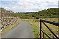
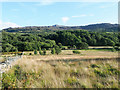
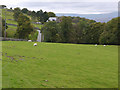
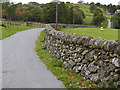
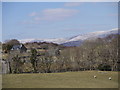
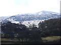
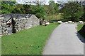
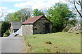
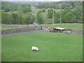
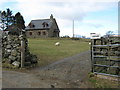
Dolgellau Community stands as a historic civil parish and small market town in Gwynedd, north-west Wales. The parish covers an area of 35.4 km² and currently holds a population of 1,418. It retains the character of a nucleated market town with narrow streets and stone buildings, positioned at the confluence of the River Wnion and Afon Aran. This location places the town beneath Cader Idris within the Snowdonia National Park, often referred to as Eryri. The town serves as the historic administrative centre of Meirionnydd, having superseded Harlech as the region's premier town by the 16th century. You find a townscape rich in heritage, featuring over 200 listed buildings and a market square established by Sir Robert Williams Vaughan in the 19th century. Life here revolves around this preserved historic core, which includes St Mary's Church and the Quaker burial ground. The setting is undeniably rural and quiet, yet it remains a functional hub with a heritage townscape actively maintained through the Dolgellau Townscape Heritage Project. For those considering homes in Dolgellau, the environment offers a distinct blend of administrative history and upland beauty, though daily life is defined by its small-scale, village atmosphere rather than modern urban convenience.
- Area Type
- Parish
- Area Size
- 35.4 km²
- Population
- 1418
- Population Density
- 594 people/km²
Demographics
The community in Dolgellau displays a distinct demographic profile dominated by older residents. With a median age of 70 years, the population skews significantly towards retirement age. This age distribution aligns with the vast majority category labelled as "Total" across the age spectrum data, indicating a population without substantial younger cohorts or working-age families as the primary driver. Specifically, 63% of households own their properties outright or with a mortgage, suggesting a stable, settled resident base rather than a transient rental market. Regarding accommodation types and household composition, the available data aggregates these metrics under broad "Total" classifications for both categories, reflecting the limited granularity of current statistics. The population density stands at 594 people per square kilometre, which indicates a relatively low-density settlement typical of upland rural areas. While the most common ethnic group, religious affiliation, and detailed deprivation indices are not itemised in the current figures, the age and ownership data paints a clear picture of a mature community. Residents here are likely retirees or long-term locals who have secured their homes, contributing to a quiet, established neighbourhood dynamic rather than a rapidly changing or diverse demographic shift.
Household Size
Accommodation Type
Tenure
Ethnic Group
Religion
Household Composition
Age
Household Deprivation
NS-SEC
Explore more demographic insights in this area
Go to Demographics tabPlanning
Planning Constraints
- Flood RiskPremium
- Ramsar Wetland SitesPremium
- Area of Outstanding Natural BeautyPremium
- Protected Nature ReservePremium
- Protected WoodlandPremium
- Crime RiskPremium