Area Overview for Llanrug Community
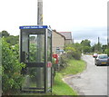
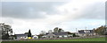
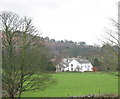
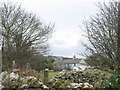
Photos of Llanrug Community

Area Information
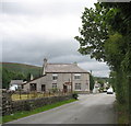
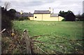
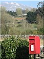
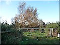
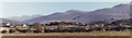
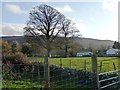
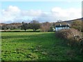
Llanrug Community stands as a distinct civil parish within Wales, covering a total area of 15.7 km². This relatively compact region offers residents a defined sense of place that balances rural serenity with essential local provision. Life here moves at a deliberate pace, characterised by a deep connection to the surrounding landscape and a strong emphasis on settled living. The area is entirely populated within parish boundaries, creating a neighbourhood where daily routines often involve short journeys to local amenities rather than long commutes to distant towns. Prospective buyers considering homes in Llanrug Community find themselves entering an established environment where the rhythm of life is dictated by local needs rather than external pressures. The parish identity provides a clear framework for understanding what daily life entails, from access to green spaces to the scope of immediate local services. You will encounter a space that values cohesion and continuity, where the physical boundaries of the 15.7 km² area influence everything from wildlife corridors to road networks. Living in Llanrug Community means embracing a setting where the land shapes the experience, offering a backdrop of stability for those seeking a life rooted in a specific locale.
- Area Type
- Parish
- Area Size
- 15.7 km²
- Population
- Not available
- Population Density
- Not available
Demographics
The population profile of Llanrug Community reveals a community dominated by older residents, with a median age of 70 years. This demographic shift shapes the social fabric, indicating that the area attracts retirees or serves as a retirement destination for families moving away from urban centres. Housing searchers looking at Llanrug Community should expect a neighbourhood where intergenerational ties are less prevalent than in younger districts. Nearly 79 per cent of households in the parish are owner-occupied, confirming that the estate is firmly established by long-term residents who have reduced their housing portfolios to single properties. The high ownership rate suggests stability, as owners are less likely to move frequently, fostering a cohesive community where neighbours know one another by name. Accommodation types reflect this pattern, with the vast majority of dwellings being standard houses rather than modern developments. You will find that the demographic makeup is consistent across the parish, with no significant variations in age or economic status. This uniformity means that the lifestyle experienced by a retiree moving into Llanrug Community will closely mirror that of their neighbours. When considering schools near Llanrug Community, you must acknowledge that the primary school-age population is naturally low given the median age.
Household Size
Accommodation Type
Tenure
Ethnic Group
Religion
Household Composition
Age
Household Deprivation
NS-SEC
Explore more demographic insights in this area
Go to Demographics tabPlanning
Planning Constraints
- Flood RiskPremium
- Ramsar Wetland SitesPremium
- Area of Outstanding Natural BeautyPremium
- Protected Nature ReservePremium
- Protected WoodlandPremium
- Crime RiskPremium