Area Overview for Criccieth Community
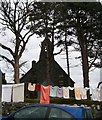
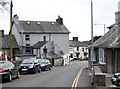
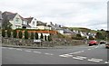
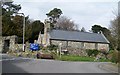
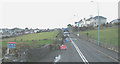
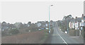
Photos of Criccieth Community


Area Information
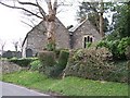
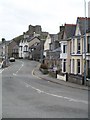
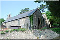
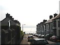
Living in Criccieth Community means residing within a civil parish in Gwynedd, Wales, that spans precisely 7.3 km². The area sits on the Llŷn Peninsula and functions as both a civil parish and a Victorian seaside resort. You will find yourself in a settlement with deep historical roots, where the medieval Criccieth Castle overlooks the town and the coastline. The town's identity shifted significantly in the 19th century when a new road arrived in 1807 and the railway connected the location in 1868. These developments transformed the place from a small coastal settlement into a popular destination for holidaymakers. You are buying into an environment defined by its historical narrative and its coastal setting. The settlement retains the character of a seaside resort established during the Victorian era. Ancient history layers beneath the modern life here, evidenced by a prehistoric chambered tomb known as Cae Dyni overlooking the coast. The settlement experienced major upheaval during Owain Glyndŵr's revolt in 1404 when the castle was sacked and burned. While the political centre left, the town found a new purpose through tourism infrastructure. Daily life in Criccieth Community is shaped by its geography and heritage. You will live in a defined area of the Llŷn Peninsula where past and present coexist. The town has evolved from a medieval stronghold into a residential and tourist hub. You can walk past ruins that date back to the reign of Llywelyn ab Iorwerth, built around 1230. The area now serves those seeking a lifestyle tied to the sea and history.
- Area Type
- Parish
- Area Size
- 7.3 km²
- Population
- Not available
- Population Density
- Not available
Demographics
The community in Criccieth Community features a distinct age profile, as the median age stands at 70 years. This indicates a population heavily weighted towards older residents. The data marks the most common age range simply as Age Total, suggesting a concentration where the elderly form the core demographic. Households in Criccieth Community show a high degree of home ownership, with 68% of residents owning their property outright. Accommodation types within the parish are recorded as total, reflecting the overall housing stock composition for the civil parish. While specific breakdowns of household composition or predominant ethnic groups are not detailed in the available records, the high home ownership rate points to a settled, long-term population. This figure of 68% ownership contrasts with housing markets that rely heavily on rentals or young professionals moving temporarily. Living here, you will notice that the demographic skew towards older residents likely influences local services and community pace. The high rate of ownership suggests many families have lived in these homes for decades. The area supports a lifestyle often preferred by retirees or those who value stability over transient living. You are part of a community where the majority hold the keys to their own dwellings.
Household Size
Accommodation Type
Tenure
Ethnic Group
Religion
Household Composition
Age
Household Deprivation
NS-SEC
Explore more demographic insights in this area
Go to Demographics tabPlanning
Planning Constraints
- Flood RiskPremium
- Ramsar Wetland SitesPremium
- Area of Outstanding Natural BeautyPremium
- Protected Nature ReservePremium
- Protected WoodlandPremium
- Crime RiskPremium