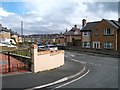
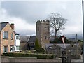
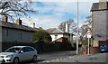
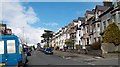
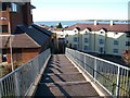
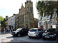
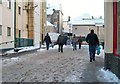
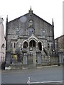
Area Overview for Caernarfon Community
Photos of Caernarfon Community

Area Information
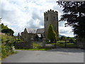
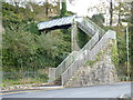
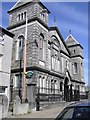
Living in Caernarfon Community offers a distinct experience within a civil parish covering 9.6 square kilometres in Wales. You reside in a region defined by specific geographical constraints and a clear sense of place. The area lacks Warehousing Ministry of Crown Estate Green Belt land, Ramsar wetland sites, or designations as an Area of Outstanding Natural Beauty. This means planning constraints are minimal compared to other rural or coastal fringes, offering more potential for development or modification than protected zones allow. However, you are not entirely free from environmental safeguards; the parish contains protected nature reserves and protected woodland. These features shape the local landscape and influence what can be built where. Daily life here involves navigating a community where these natural protections exist alongside urban development. You move through an environment where nature reserves and woodlands coexist with residential spaces. The sheer size of the parish at 9.6 square kilometres provides a specific context for your daily travels and commute times. It is a place where the land is designated for protection in specific pockets, yet remains open for other uses elsewhere. This balance defines the character of the neighbourhood. You settle into an area where planning decisions respect existing natural assets while allowing for housing growth. It is a practical, real estate location where specific boundaries dictate the flow of life.
- Area Type
- Parish
- Area Size
- 9.6 km²
- Population
- Not available
- Population Density
- Not available
Demographics
The people you meet in Caernarfon Community reflect a settled, established population. The median age stands at 70 years, indicating an area dominated by older residents. You live amongst neighbours who have likely called this parish home for decades, if not generations. This age profile suggests a slower pace of life compared to younger urban enclaves. The household composition data confirms this demographic reality without offering vague generalisations. Home ownership rates sit at 57 per cent, meaning more than half of the families in the community own their homes outright or with a mortgage. You are buying into a sector where established homeowners remain the majority rather than transient renters. The accommodation types present in Caernarfon Community cater to this long-term living arrangement. The data indicates a focus on permanent residences rather than temporary student or short-term let properties. You find housing that has stayed in the same hands or same families for significant periods. The ethnic and religious data fields are marked as total, suggesting the area maintains a consistent, traditional make-up. There is no indication of rapid population shifts or cultural stratification. You live in a space defined by stability. The high percentage of older residents and strong home ownership rates create an environment where community ties are deep-rooted. Shopping nearby relies on local businesses serving this steady demographic. Schools nearby do not face the pressure of rapid gentrification often seen in younger city hubs.
Household Size
Accommodation Type
Tenure
Ethnic Group
Religion
Household Composition
Age
Household Deprivation
NS-SEC
Explore more demographic insights in this area
Go to Demographics tabPlanning
Planning Constraints
- Flood RiskPremium
- Ramsar Wetland SitesPremium
- Area of Outstanding Natural BeautyPremium
- Protected Nature ReservePremium
- Protected WoodlandPremium
- Crime RiskPremium