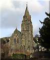
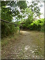
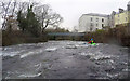
Area Overview for Bethesda Community
Photos of Bethesda Community
Area Information
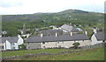
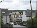
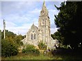
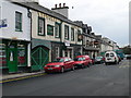
Living in Bethesda Community offers a distinctly rural experience within the parish of the same name. This civil parish covers an area of 3.9 km², providing a defined and manageable settlement for residents. You will find a location characterised by its size and rural setting, making it suitable for those seeking a quieter lifestyle away from urban centres. The compact nature of the parish means that daily needs are likely concentrated, though the specific boundaries often blend into the surrounding countryside. Prospective buyers should expect a setting that prioritises space and tranquillity over the buzz of a high-density town. The area serves as a parish within Wales, highlighting its administrative and cultural ties to the region. Homebuyers choosing homes in Bethesda Community are selecting a life defined by these geographical constraints. The physical limits of the 3.9 km² footprint shape the neighbourhood density and the pace of local life. This overview sets the stage for understanding the practicalities of daily living here. While the data focuses on the civil parish structure, the reality for residents involves navigating this specific landscape. If you are considering a move, you are looking at a defined community with clear physical boundaries. The local environment dictates the rhythm of life, from walking distances to the expanse of green space available around your future property.
- Area Type
- Parish
- Area Size
- 3.9 km²
- Population
- Not available
- Population Density
- Not available
Demographics
The community in Bethesda Community reflects an older population, with a median age of 70 years. This figure indicates that the residents are predominantly older adults. The most common age range recorded is simply listed as Age: Total, suggesting a broad distribution across the senior demographic rather than a young family demographic. Consequently, you are unlikely to find clusters of young professionals or large families raising children in the immediate vicinity. Home ownership stands at 65% within the parish. This statistic confirms that the majority of households own their accommodation outright or with a mortgage. The remaining 35% represents households that rent or occupy properties owned by others. This high ownership rate suggests financial stability among current residents and a reluctance to move shortly after purchasing. The accommodation type category is marked as total, indicating an aggregate view of housing forms rather than specific tenures like flats or terraced houses. Ethnic diversity is noted as total, meaning no specific predominant group is highlighted in the available statistics. Religion is similarly recorded as total, without a primary faith community singled out in the data. With a median age of 70 and a 65% ownership rate, the demographic profile points towards a settled, older population accustomed to long-term residency. Buyers should expect a neighbourly environment where lifelong residents form the core of the social fabric. The lack of young families and the high age profile create a specific social atmosphere that differs from most growing urban or suburban towns.
Household Size
Accommodation Type
Tenure
Ethnic Group
Religion
Household Composition
Age
Household Deprivation
NS-SEC
Explore more demographic insights in this area
Go to Demographics tabPlanning
Planning Constraints
- Flood RiskPremium
- Ramsar Wetland SitesPremium
- Area of Outstanding Natural BeautyPremium
- Protected WoodlandPremium
- Crime RiskPremium