Area Overview for Whitford Community
Photos of Whitford Community
Area Information
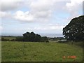
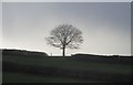
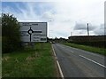
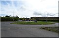
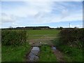
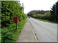
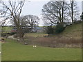
Whitford Community sits on the border of Flintshire in Wales, covering an area of 21.4 km². The centre of the community is near the CH8 8SG postcode, yet the settlement extends broadly across the surrounding landscape. You are not just buying a house in Whitford; you are entering a civil parish that includes five distinct villages. These include Carmel, Gorsedd, Lloc, Pantasaph, and Whitford itself. Together, these villages encompass nearly 8,000 acres of land that rise gradually from the Dee estuary into the hills to the north-west. This geography creates a varied environment where living in Whitford means navigating both coastal influences and hilly terrain. The primary village of Whitford holds a population of approximately 2,243 residents. This figure includes households in the neighbouring settlements that make up the unitary electoral division. Daily life here revolves around local history and community ownership. The community purchased Glebe Field in 1976 specifically to prevent further development on that land. This long-standing commitment protects the green spaces you will see around you. The area is defined by its ancient roots, from Bronze Age tumuli to Norman churches, which gives the neighbourhood a quiet, established character. You live within a setting where the past remains very visible in the local built environment. Houses and schools bear witness to centuries of history. The Church of St Mary and St Beuno stands as a focal point, alongside later structures like the Gorsedd church built in 1852. If you are considering homes in Whitford, expect a environment guided by planning constraints designed to preserve these unique local landscapes rather than rapid growth.
- Area Type
- Parish
- Area Size
- 21.4 km²
- Population
- Not available
- Population Density
- Not available
Demographics
The residents of Whitford Community are older than the national average, with a median age of 70 years old. This demographic profile indicates that schools near Whitford primarily serve families with young children who have likely moved up from more urban centres. The community is not a young professional area or a retirement hub in the traditional sense, but rather a settled population. Age distribution data suggests that the majority of the population falls across wide age ranges, with the oldest residents forming the numerical median. Home ownership is the dominant arrangement in Whitford. According to the latest census data, 88% of residents own their homes. This high percentage reflects a community where property accumulation and stability are common. You are unlikely to find a large transient rental population here. Instead, the area attracts long-term residents who have Roots in the region. This stability influences the social fabric of the villages and the pace of daily life. Accommodation types in the area reflect this owner-occupied nature. The housing stock consists largely of family homes that may be several decades old, fitting the communities of the 1850s and 1950s mentioned in local history. There is little indication of recent large-scale development projects altering the balance of the housing market. The demographic make-up remains relatively homogeneous in terms of tenure. You will find a community where neighbours know each other well, a trait often found in estates where buy-to-let investments are not the primary driver of the market.
Household Size
Accommodation Type
Tenure
Ethnic Group
Religion
Household Composition
Age
Household Deprivation
NS-SEC
Explore more demographic insights in this area
Go to Demographics tabPlanning
Planning Constraints
- Flood RiskPremium
- Ramsar Wetland SitesPremium
- Area of Outstanding Natural BeautyPremium
- Protected WoodlandPremium
- Crime RiskPremium