Area Overview for Northop Hall Community
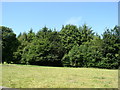
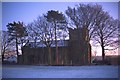
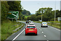
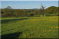
Photos of Northop Hall Community
Area Information
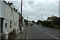
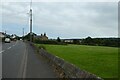
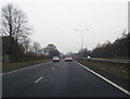
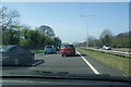
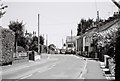
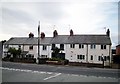
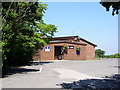
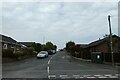
Northop Hall Community stands as a distinct civil parish within Flintshire, covering a compact area of 3.5 km². The village acts as a residential hub situated near Mold and east of Northop, positioned conveniently close to the A55 North Wales Expressway. Current population figures suggest between 1,600 and 1,665 residents, creating an intimate community feel that belies its ancient roots. History in this area extends back to 550 AD when St Eurgain reportedly founded the first church, with Roman soldiers likely marching through the land centuries before that. The current population density results from significant expansion during the post-war period, particularly from the 1960s onwards, which introduced new estates alongside the original village character. Daily life here revolves around specific local landmarks and active community institutions. You will find the Edith Bankes Memorial Institute, built in 1932 with funds from Sir John Eldon Bankes, standing as a focal point for social engagement. Nearby, the Analemmatic Dial installed in 2000 offers a unique visual feature in front of the institute. The village maintains a strong sporting identity through the Northop Cricket Club, established in 1869, alongside the Northop Band founded in 1892. Two notable public houses, the Boar's Head and the Black Lion, operate locally as the 'Top Monkey' and 'Bottom Monkey'. Living in Northop Hall Community means residing in a place where 13th-century manor history coexists with modern housing developments, offering a rooted yet evolving environment for current residents.
- Area Type
- Parish
- Area Size
- 3.5 km²
- Population
- Not available
- Population Density
- Not available
Demographics
The demographic profile of Northop Hall Community reveals an exceptionally settled and mature population. The median age for residents is 70 years, indicating that the area is dominated by older generations. This high age figure suggests a neighbourhood where families with young children are less likely to be the primary demographic compared to retirement-age households. While specific data on household composition types or predominant ethnic groups is not available in the current records, the overall community structure points towards stability rather than rapid turnover or migration. Home ownership stands at a remarkably high level of 85% within the parish. This statistic confirms that the vast majority of inhabitants own their residences outright or have significant ownership stakes. Consequently, the area exemplifies a market where selling a second home or moving frequently is uncommon, leading to established neighbourhood ties. The combination of a median age of 70 and an 85% ownership rate paints a picture of residents who have remained in their homes for decades. You will find a community where long-term permanence is the norm, with homes in Northop Hall Community primarily occupied by those who have built a life here over many years. This high retention rate contributes to a quiet, consistent atmosphere where local customs and routines persist through generations.
Household Size
Accommodation Type
Tenure
Ethnic Group
Religion
Household Composition
Age
Household Deprivation
NS-SEC
Explore more demographic insights in this area
Go to Demographics tabPlanning
Planning Constraints
- Flood RiskPremium
- Ramsar Wetland SitesPremium
- Area of Outstanding Natural BeautyPremium
- Protected Nature ReservePremium
- Protected WoodlandPremium
- Crime RiskPremium