Area Overview for Higher Kinnerton Community
Photos of Higher Kinnerton Community
Area Information
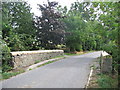
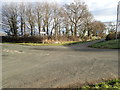
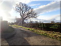
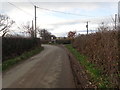
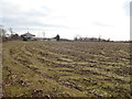
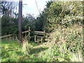
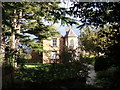
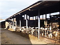
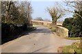
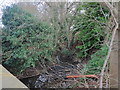
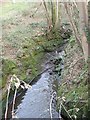
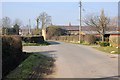
Higher Kinnerton Community stands as a distinct civil parish in rural Flintshire, Wales, covering an area of 8.2 square kilometres. This village sits close to the Wales-England border, directly adjacent to its sister village, Lower Kinnerton, in Cheshire. Historical evidence shows Celtic settlements from pagan times, with the community developing significantly during the Industrial Revolution. A railway station once served the area until its dismantling in the 1960s, leaving a popular footpath in its wake. The village has consistently won the Flintshire Best Kept Community awards in 2012, 2014, 2017, and 2019, reflecting a genuine commitment to local upkeep and appearance. Residents describe the location as a desirable place to live, valued for its welcoming atmosphere and strong community cohesion. The population consists of approximately 1,697 people according to the 2011 census, offering a modest scale that avoids urban density while providing essential amenities. Daily life centres around notable landmarks such as Ysgol Derwen primary school and a centrally located village hall. Families and individuals with faiths and backgrounds of all kinds find a supportive environment here, often supported by local groups catering to specific interests. The site is characterised by English as the primary language, though informal Welsh is heard within the community. Former residents of the area have linked local listed buildings to significant historical figures, including the founders of Aintree racecourse. This setting supports those who appreciate a rural environment with professional local governance as part of their lifestyle choices.
- Area Type
- Parish
- Area Size
- 8.2 km²
- Population
- Not available
- Population Density
- Not available
Demographics
The demographic profile of Higher Kinnerton Community reveals a settlement with an older population structure. The median age across the village stands at 70 years, indicating that the community attracts不少人 seeking quieter living arrangements in later life. While specific data on household composition and predominant ethnic groups is not detailed in the available records, the character of the village suggests a diverse mix of backgrounds united by shared local values. Religious affiliation data is similarly not specified, yet the narrative of the area highlights a welcoming atmosphere for residents of all faiths. Home ownership defines the financial landscape of the parish. An impressive 87% of households own their homes, suggesting a stable community where long-term residency is common. This high rate contrasts sharply with typical rental-heavy urban centres. The remaining households comprise those who rent, representing an individual inventory of accommodation types not fully broken down by the current dataset. You will find a population that has invested significantly in the local housing stock over decades rather than transient tenants looking for short-term stays. This level of ownership stability often correlates with lower turnover rates and a more cohesive neighbourly dynamic. For you as a potential buyer, this means entering a market where people tend to stay put. The absence of specific statistics on deprivation levels does not diminish the clear picture of a community defined by high property retention and a mature age profile.
Household Size
Accommodation Type
Tenure
Ethnic Group
Religion
Household Composition
Age
Household Deprivation
NS-SEC
Explore more demographic insights in this area
Go to Demographics tabPlanning
Planning Constraints
- Flood RiskPremium
- Ramsar Wetland SitesPremium
- Area of Outstanding Natural BeautyPremium
- Protected Nature ReservePremium
- Protected WoodlandPremium
- Crime RiskPremium