Area Overview for Holywell Community
Photos of Holywell Community
Area Information
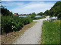
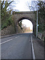
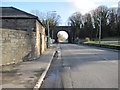
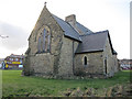
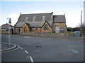
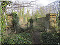
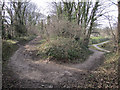
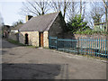
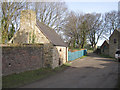
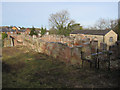
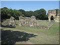
Holywell Community stands as a distinct civil parish within Flintshire, situated to the west of the River Dee estuary in north-east Wales. This area covers 17.5 km² and houses a population of 1,229 residents, creating a community with a notably sparse density of 70 people per square kilometre. Your daily life here is shaped by historic landmarks rather than modern high-rises, most notably St Winefride's Well. This site, surrounded by a chapel, operates as a grade I listed building and claims to be the oldest continually visited pilgrimage site in Great Britain. The town's identity is deeply rooted in this religious heritage, often referred to locally as the Lourdes of Wales, attracting visitors from across the country alongside local residents. The landscape also includes significant historical remnants like the ruins of Basingwerk Abbey, which Benedictine and later Cistercian monks occupied for four centuries. You will find the community defined by its connection to these ancient sites and the adjacent Greenfield area. The presence of Greenfield Valley Heritage Park, which houses copper plates from HMS Victory, further enriches the local cultural scene without expanding the built-up footprint significantly. Living in Holywell Community means engaging with an environment where Neolithic cairns and medieval earth banks like Wat's Dyke still feature prominently in the scenery. The area maintains a quiet, preserved character, reflecting its status as a historic market town that has seen evolution from early Christian communities to an industrial past and a modern, low-density residential setting. This unique blend of deep history and open space defines the experience for anyone seeking homes in Holywell.
- Area Type
- Parish
- Area Size
- 17.5 km²
- Population
- 1229
- Population Density
- 70 people/km²
Demographics
The community you are considering entering presents a distinct age profile with a median age of 70. This figure indicates that the majority of residents fall into older age brackets compared to the national average. While the most common age range is simply recorded as the total population, the high median age suggests a demographic leaning towards retirees or long-standing elderly residents rather than a young professional workforce. With a population of 1,229 spread across 17.5 km², the social environment is intimate and localised. Home ownership plays a significant role in the stability of the neighbourhood, with 58% of households in the parish being owner-occupied. This majority proportion typically implies a community with deep local roots where residents have made a long-term commitment to the area. The remaining 42% of households rely on renting, which reflects a balance between private ownership and temporary tenure options typical of rural Welsh parishes. Specific data on household composition, predominant ethnic groups, and religious affiliations is not broken down in the available records, but the high home ownership rate strongly points to a sedentary population. The low density of 70 people per square kilometre reinforces the quiet nature of living here, where neighbours are likely to know each other well across the limited number of streets. This demographic structure supports a slower pace of life, suitable for those seeking stability over vibrancy.
Household Size
Accommodation Type
Tenure
Ethnic Group
Religion
Household Composition
Age
Household Deprivation
NS-SEC
Explore more demographic insights in this area
Go to Demographics tabPlanning
Planning Constraints
- Flood RiskPremium
- Ramsar Wetland SitesPremium
- Area of Outstanding Natural BeautyPremium
- Protected Nature ReservePremium
- Protected WoodlandPremium
- Crime RiskPremium