Area Overview for Connah's Quay Community
Photos of Connah's Quay Community


Area Information
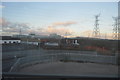
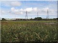
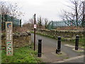
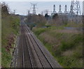
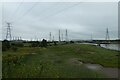
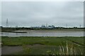
Connah's Quay Community stands as a distinct civil parish within Flintshire, Wales, offering a specific residential experience for those seeking homes here. The parish covers an area of 19.9 km² and holds a population of 5,401 residents. While the wider town serves roughly 23,000 people including the adjacent area of Shotton, this specific community defining the civil parish offers a more contained local environment. You will find a place shaped by historic maritime trade and heavy industry, yet it has evolved into a primarily residential setting. The location sits on the banks of the River Dee estuary, a geographic feature that defined the town's early development around the late 18th century. Daily life in Connah's Quay Community reflects this background, with local businesses and further education colleges playing a central role in modern activity. The site of the historic Ferguson & Baird shipyard and the nearby Deeside Stadium serve as notable landmarks near Old Quay House. Living in Connah's Quay Community means accessing a town with deep roots in shipbuilding and railway freight, now transitioning into a settled neighbourhood. The area provides a tangible connection to Welsh industrial heritage, anchored by the River Dee and the practical infrastructure of Coleg Cambria. This mix of history and current function creates a defined character for those considering the parish.
- Area Type
- Parish
- Area Size
- 19.9 km²
- Population
- 5401
- Population Density
- 272 people/km²
Demographics
The people living in Connah's Quay Community form a uniquely settled demographic profile. Statistics indicate that 70% of households in the area are owner-occupied, suggesting a community with long-term residents rather than a high-turnover rental market. The population structure is heavily weighted towards older age groups, with a median age of 70 years. This figure implies that families with young children are less common than they might be in other parts of Wales. Instead, the household composition likely consists of retirement homes or older adults who have lived there for decades. You will encounter a neighbourhood where residents have invested significantly in their local properties, evidenced by the high home ownership rate. The area does not show data for specific ethnic diversity or religious breakdowns, so the community feel relies on these structural demographics rather than cultural statistics. This age profile influences local services and amenities, creating an environment suited to mature living. A high proportion of owners typically results in greater maintenance of housing stock and local institutions. When you consider living in Connah's Quay Community, you are entering an area defined by stability and established residency patterns rather than transient populations or rapid demographic shifts.
Household Size
Accommodation Type
Tenure
Ethnic Group
Religion
Household Composition
Age
Household Deprivation
NS-SEC
Explore more demographic insights in this area
Go to Demographics tabPlanning
Planning Constraints
- Flood RiskPremium
- Ramsar Wetland SitesPremium
- Area of Outstanding Natural BeautyPremium
- Protected Nature ReservePremium
- Protected WoodlandPremium
- Crime RiskPremium