Area Overview for Buckley Community
Photos of Buckley Community
Area Information
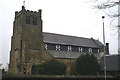
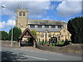
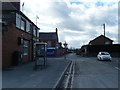
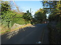
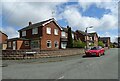
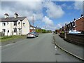
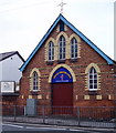
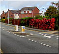
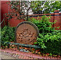
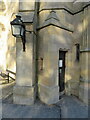
You are looking at Buckley Community, a civil parish located in Flintshire, Wales. The town spans 10.6 km² and currently holds a population of 6,513 residents. While historical records note a wider community figure from the 2021 census, this parish delivers a defined, settled environment for those considering living in Buckley. The area sits within the historic manor pasturage of Ewloe, carrying heritage roots that date back to the Domesday Book of 1086. You will find a sense of continuity here, with the parish forming in 1822 and gaining urban district status in 1898. Daily life blends these historical layers with modern living, relying on a compact footprint that fosters a tight-knit neighbourhood feel. The local identity is anchored by significant historical touchpoints, including the Buckley Town & Heritage Trail and sites related to John 'Iron Mad' Wilkinson's 1797 smelt foundry. Religious sites define the landscape, such as St Matthew's Church, consecrated in 1822, and Bistre Emmanuel Parish Church from 1842. You gain easy access to heritage locations without needing to travel far, as the area contains markers for non-conformist sites like the mound near the Elfed Sports Complex. When you visit Buckley Community, you encounter an environment shaped by its industrial past of coal mining and pottery production, yet now focused on peaceful domestic life. Homes in Buckley offer proximity to local amenities and green spaces without the isolation of rural living. The parish boundary provides a clear definition for residents, ensuring you know exactly where you live within the broader Flintshire council area. Whether you are walking through Spon Green or visiting the nearby Llys Wilkinson site, the tangible connection to history remains strong. This makes Buckley a compelling choice for buyers who value established communities with deep roots and a manageable size. The balance between open space and residential density creates a balanced lifestyle for long-term living in this Welsh parish.
- Area Type
- Parish
- Area Size
- 10.6 km²
- Population
- 6513
- Population Density
- 615 people/km²
Demographics
The demographic profile of Buckley Community reveals an older population compared to the national average. Residents in this parish have a median age of 70 years, indicating a community where mature adults and retirees form the core of the neighbourhood. This age distribution suggests that if you choose to live in Buckley, you will be joining an environment dominated by older demographics. The high concentration of residents in later life stages also means you may find fewer young families compared to urban centres in England. Property ownership is a defining characteristic of Buckley, with 72% of homes under owner-occupation. This figure places the area firmly in the category of settled homeowners rather than a transient rental market. Such a high level of owner-occupancy typically correlates with lower crime rates and a more stable environment where residents maintain their properties for the long term. The remaining 28% of households are likely rented properties, but the overwhelming majority of people who call Buckley home own their residences. Accommodation types reflect traditional Welsh building methods adapted for the local climate, though specific breakdowns of flat versus house counts were not included in the source data. You should expect to find a mixture of semis and detached homes suited to this parochial setting. The household composition data confirms a total population base that supports local services, ensuring shops and pubs remain viable for the neighbourhood. Estate agents often describe such stability as a benefit, as owners are less likely to sell quickly during economic downturns. For those seeking a quiet, owner-stocked community, the statistics on Buckley Community validate your expectations for a sober, established housing stock.
Household Size
Accommodation Type
Tenure
Ethnic Group
Religion
Household Composition
Age
Household Deprivation
NS-SEC
Explore more demographic insights in this area
Go to Demographics tabPlanning
Planning Constraints
- Flood RiskPremium
- Ramsar Wetland SitesPremium
- Area of Outstanding Natural BeautyPremium
- Protected Nature ReservePremium
- Protected WoodlandPremium
- Crime RiskPremium