Area Overview for Llandrillo Community
Photos of Llandrillo Community
Area Information
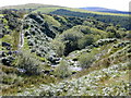
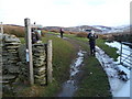
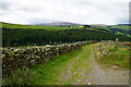
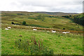
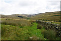
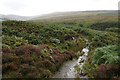
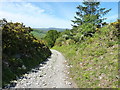
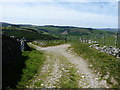
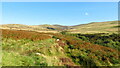
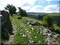
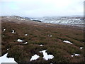
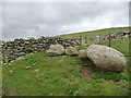
Living in Llandrillo Community offers a distinct experience shaped by its size and character. This civil parish covers 62.3 km² of land in Wales, providing a defined rural setting for residents. The area functions as a typical Welsh parish, where the landscape likely influences daily routines and community interactions. You can expect a setting that balances the quiet of the countryside with the practicalities of settled life. The physical extent of the parish means travel distances play a significant role in how you navigate your daily activities. There are no luxury descriptors to rely on; the appeal lies in the tangible space and the established nature of the locality. The identity of the place is rooted in its geographical boundaries and administrative status as a civil parish. This structure often supports local governance and community initiatives specific to the region. When considering homes in Llandrillo Community, you are entering an area where the environment dictates the pace of life. The 62.3 km² footprint suggests enough space for open views and potentially lower density living compared to urban centres. It is a location defined by its physical scale and its status within the wider Welsh administrative framework. Your daily life here will naturally revolve around these fixed geographical realities.
- Area Type
- Parish
- Area Size
- 62.3 km²
- Population
- Not available
- Population Density
- Not available
Demographics
The community within Llandrillo Community is defined by a very specific age profile. The median age stands at 70 years, indicating that the population skews significantly towards seniors. This demographic shift suggests a neighbourhood where residents are likely settled and perhaps enjoying retirement life. Most common age data reflects this older profile, showing that younger families are less dominant in the current population structure. Understanding this age distribution is crucial for anyone considering living in Llandrillo Community, as it shapes the culture and available amenities. Home ownership levels are exceptionally high in this area. A staggering 71% of households own their homes outright. This statistic points to a location with strong roots and a settled population that has invested long-term in the local property market. Such high ownership rates often correlate with stability and a community that changes slowly over time. The household composition data, while presented as a total category, supports the view of established living arrangements rather than transient or student-heavy housing. This ownership texture creates a unique social fabric where residents are deeply embedded in the locality.
Household Size
Accommodation Type
Tenure
Ethnic Group
Religion
Household Composition
Age
Household Deprivation
NS-SEC
Explore more demographic insights in this area
Go to Demographics tabPlanning
Planning Constraints
- Flood RiskPremium
- Ramsar Wetland SitesPremium
- Area of Outstanding Natural BeautyPremium
- Protected Nature ReservePremium
- Protected WoodlandPremium
- Crime RiskPremium