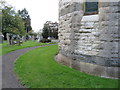
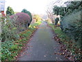
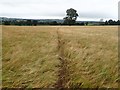
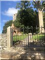
Area Overview for Llanbedr Dyffryn Clwyd Community
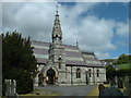
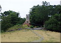
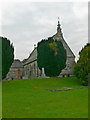
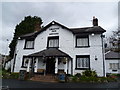
Photos of Llanbedr Dyffryn Clwyd Community
Area Information
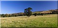
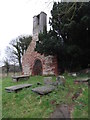
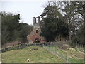
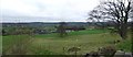
Living in Llanbedr Dyffryn Clwyd Community offers a distinct experience within a civil parish that spans 16.5 square kilometres. This Welsh locale provides a specific setting where the landscape itself shapes daily life. The area is defined by its administrative status as a parish, which often implies a close-knit governance structure and a defined community identity. Residents here navigate a environment that balances rural access with local infrastructure. The physical size of the parish means distances between any two points are measurable and significant for those commuting or accessing services. You will find that the geography supports a lifestyle centred on locality rather than city-centre convenience. The designation as a civil parish ensures local planning decisions consider the specific constraints and opportunities of this 16.5 km² footprint. Prospective buyers looking at Llanbedr Dyffryn Clwyd Community should understand the scale of their future amenity area. The area encompasses a variety of land uses typical of a Welsh parish, though specific details on those uses are limited in available records. Your connection to the wider region depends on how you utilise this 16.5 km² space. Living here requires an appreciation for the defined boundaries of the parish and the unique characteristics that emerge within them. The community functions as an independent entity, managing its own affairs while remaining part of the broader county structure. For you, this means knowing exactly what the parish offers in terms of administration and local representation.
- Area Type
- Parish
- Area Size
- 16.5 km²
- Population
- Not available
- Population Density
- Not available
Demographics
The demographic profile of Llanbedr Dyffryn Clwyd Community presents a clear picture of an established settlement. The median age for residents reaches 70, indicating a population skewed significantly towards older adults. This age distribution suggests a community where retirement or senior living plays a central role in social dynamics. You should note that this high median age influences local service needs, from healthcare provision to leisure activities suitable for mature residents. The data identifies a total age category as the most common, confirming the broad spread of ages that culminates in this median figure. Home ownership stands at a notable 74% of the total population. This high ownership rate paints a clear picture of stability within Llanbedr Dyffryn Clwyd Community. Most households likely consist of long-term owners rather than renters, which can impact the availability of properties for new buyers. The household composition data is recorded generally, reflecting the standard parsing of census information for this parish. Accommodation types are similarly categorised in total figures, providing a baseline for the variety of housing available. Diversity metrics are recorded but do not highlight a specific predominant ethnic group, suggesting a generally homogenous population typical of many Welsh rural parishes. Religion data exists in total form, indicating that local faith communities play a recognised role. There is no separate deprivation data provided, so you must rely on ownership stats and age profiles to gauge economic conditions in Llanbedr Dyffryn Clwyd Community.
Household Size
Accommodation Type
Tenure
Ethnic Group
Religion
Household Composition
Age
Household Deprivation
NS-SEC
Explore more demographic insights in this area
Go to Demographics tabPlanning
Planning Constraints
- Flood RiskPremium
- Ramsar Wetland SitesPremium
- Area of Outstanding Natural BeautyPremium
- Protected Nature ReservePremium
- Protected WoodlandPremium
- Crime RiskPremium