Area Overview for LL22 9DS
Photos of LL22 9DS
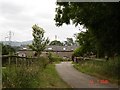
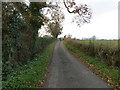

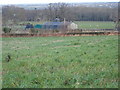
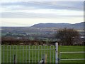
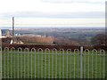
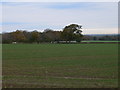


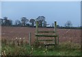
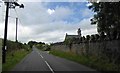
17 photos from this area
Area Information
Key information about the LL22 9DS including its size, population, and administrative classification.
- Area Type
- Postcode
- Area Size
- 46.5 hectares
- Population
- 1817
- Population Density
- 71 people/km²
House Prices in LL22 9DS
12
Properties
£259,520
Average Sold Price
£50,600
Lowest Price
£450,000
Highest Price
Showing 12 properties
| Address | Type | Beds | Baths | Last Sale Price | Last Sale Date | |
|---|---|---|---|---|---|---|
| Bryn Teg, Cae Onnen To Maes, Groesffordd Marli, Abergele, LL22 9DS | Bungalow | - | - | £450,000 | Nov 2021 | |
| Y Wern, Cae Onnen To Maes, Groesffordd Marli, Abergele, LL22 9DS | Bungalow | 3 | - | £315,000 | Jun 2017 | |
| Coed Madog, Cae Onnen To Maes, Groesffordd Marli, Abergele, LL22 9DS | house | 4 | - | £337,000 | Dec 2012 | |
| Plas Newydd Bach, Cae Onnen To Maes, Groesffordd Marli, Abergele, LL22 9DS | Semi-detached | - | - | £145,000 | Jul 2003 | |
| Llys Y Coed, Cae Onnen To Maes, Groesffordd Marli, Abergele, LL22 9DS | Detached | - | - | £50,600 | Feb 1996 | |
| Bodoryn, 0 , Groesffordd Marli, Abergele, LL22 9DS | Detached | 4 | 2 | - | - | |
| Plas Hafod, Cae Onnen To Maes, Groesffordd Marli, Abergele, LL22 9DS | Detached | 4 | 2 | - | - | |
| Tal Y Graig, Ysgol Cefn Meiriadog To Pentre Mawr Junction, Groesffordd Marli, Abergele, LL22 9DS | Detached | 5 | 3 | - | - | |
| Marllwyn, Glascoed Road, Glascoed, Abergele, LL22 9DS | house | - | - | - | - | |
| Tyddyn Rhys, Cae Onnen To Maes, Groesffordd Marli, Abergele, LL22 9DS | Detached | - | - | - | - |
Page 1 of 2
Energy Efficiency in LL22 9DS
Amenities
Schools
| Rank | School | Type | Entry gender | Ages |
|---|
Explore more schools in this area
Go to Schools tabDemographics
Household Size
Two person
most common
Accommodation Type
Houses
most common
Tenure
75
majority
Ethnic Group
White
most common
Religion
N/A
most common
Household Composition
N/A
most common
Age
47
median
Adults (30-64 years)
most common
Household Deprivation
N/A
with no deprivation
NS-SEC
34
in Lower managerial occupations
Explore more demographic insights in this area
Go to Demographics tabPlanning
Planning Constraints
- Flood RiskPremium
- Ramsar Wetland SitesPremium
- Area of Outstanding Natural BeautyPremium
- Protected Nature ReservePremium
- Protected WoodlandPremium
- Crime RiskPremium