Area Overview for LL19 9PL
Photos of LL19 9PL
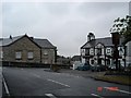
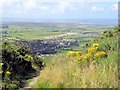
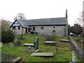
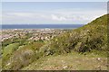

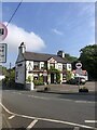


30 photos from this area
Area Information
Key information about the LL19 9PL including its size, population, and administrative classification.
- Area Type
- Postcode
- Area Size
- 26.6 hectares
- Population
- 2002
- Population Density
- 1256 people/km²
House Prices in LL19 9PL
28
Properties
£192,902
Average Sold Price
£45,000
Lowest Price
£500,000
Highest Price
Showing 28 properties
| Address | Type | Beds | Baths | Last Sale Price | Last Sale Date | |
|---|---|---|---|---|---|---|
| Greycote, Bishopswood Road, Prestatyn, LL19 9PL | Detached | 5 | 3 | £500,000 | Jan 2022 | |
| Bodfaen, Bishopswood Road, Prestatyn, LL19 9PL | Detached | 5 | 2 | £355,000 | Aug 2017 | |
| Mandalay, Bishopswood Road, Prestatyn, LL19 9PL | house | 3 | 2 | £195,000 | Feb 2017 | |
| Highfield, Bishopswood Road, Prestatyn, LL19 9PL | house | 4 | - | £450,000 | Feb 2016 | |
| Fox Hill, Bishopswood Road, Prestatyn, LL19 9PL | Detached | 5 | 3 | £140,088 | Aug 2015 | |
| Grafton, 0 Bishopswood Road, Prestatyn, LL19 9PL | Bungalow | 3 | 1 | £208,000 | Jun 2014 | |
| Walden, Bishopswood Road, Prestatyn, LL19 9PL | Detached | - | - | £55,000 | Dec 2012 | |
| Carreg Wen, Bishopswood Road, Prestatyn, LL19 9PL | house | - | - | £215,000 | Sep 2010 | |
| St. Marys, 0 Bishopswood Road, Prestatyn, LL19 9PL | Detached | 5 | 3 | £340,000 | Sep 2006 | |
| Sungather, Bishopswood Road, Prestatyn, LL19 9PL | Semi-detached | - | - | £135,000 | Jul 2003 |
Page 1 of 3
Energy Efficiency in LL19 9PL
Amenities
Schools
| Rank | School | Type | Entry gender | Ages |
|---|
Explore more schools in this area
Go to Schools tabDemographics
Household Size
Two person
most common
Accommodation Type
Houses
most common
Tenure
71
majority
Ethnic Group
White
most common
Religion
N/A
most common
Household Composition
N/A
most common
Age
47
median
Adults (30-64 years)
most common
Household Deprivation
N/A
with no deprivation
NS-SEC
29
in Lower managerial occupations
Explore more demographic insights in this area
Go to Demographics tabPlanning
Planning Constraints
- Flood RiskPremium
- Ramsar Wetland SitesPremium
- Area of Outstanding Natural BeautyPremium
- Protected Nature ReservePremium
- Protected WoodlandPremium
- Crime RiskPremium