Area Overview for LL19 9EF
Photos of LL19 9EF
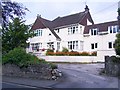
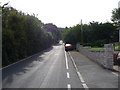
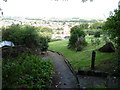
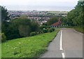
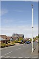
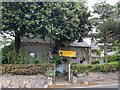
21 photos from this area
Area Information
Key information about the LL19 9EF including its size, population, and administrative classification.
- Area Type
- Postcode
- Area Size
- 6720 m²
- Population
- 1465
- Population Density
- 2838 people/km²
House Prices in LL19 9EF
8
Properties
£236,750
Average Sold Price
£77,500
Lowest Price
£580,000
Highest Price
Showing 8 properties
| Address | Type | Beds | Baths | Last Sale Price | Last Sale Date | |
|---|---|---|---|---|---|---|
| 50 Linden Walk, Prestatyn, LL19 9EF | Detached | 6 | 4 | £580,000 | Dec 2022 | |
| 44 Linden Walk, Prestatyn, LL19 9EF | Bungalow | 2 | 2 | £183,000 | May 2019 | |
| 52 Linden Walk, Prestatyn, LL19 9EF | Detached | 3 | 1 | £280,000 | Nov 2018 | |
| 46 Linden Walk, Prestatyn, LL19 9EF | Bungalow | 3 | - | £177,000 | Mar 2016 | |
| 54 Linden Walk, Prestatyn, LL19 9EF | Detached | - | - | £77,500 | Sep 1999 | |
| 48 Linden Walk, Prestatyn, LL19 9EF | Detached | - | - | £123,000 | Apr 1999 | |
| Office At, 54 Linden Walk, Prestatyn, LL19 9EF | Office | - | - | - | - | |
| 56 Linden Walk, Prestatyn, LL19 9EF | Detached | - | - | - | - |
Energy Efficiency in LL19 9EF
Amenities
Schools
| Rank | School | Type | Entry gender | Ages |
|---|
Explore more schools in this area
Go to Schools tabDemographics
Household Size
Two person
most common
Accommodation Type
Houses
most common
Tenure
90
majority
Ethnic Group
White
most common
Religion
N/A
most common
Household Composition
N/A
most common
Age
47
median
Adults (30-64 years)
most common
Household Deprivation
N/A
with no deprivation
NS-SEC
42
in Lower managerial occupations
Explore more demographic insights in this area
Go to Demographics tabPlanning
Planning Constraints
- Flood RiskPremium
- Ramsar Wetland SitesPremium
- Area of Outstanding Natural BeautyPremium
- Protected Nature ReservePremium
- Protected WoodlandPremium
- Crime RiskPremium