Area Overview for LL19 9DL
Photos of LL19 9DL
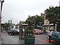
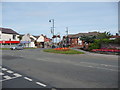
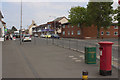
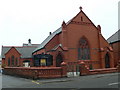
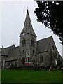
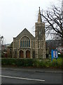
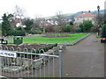
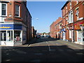
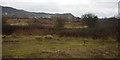
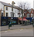

71 photos from this area
Area Information
Key information about the LL19 9DL including its size, population, and administrative classification.
- Area Type
- Postcode
- Area Size
- 7960 m²
- Population
- 1328
- Population Density
- 2131 people/km²
House Prices in LL19 9DL
24
Properties
£135,917
Average Sold Price
£45,000
Lowest Price
£196,000
Highest Price
Showing 24 properties
| Address | Type | Beds | Baths | Last Sale Price | Last Sale Date | |
|---|---|---|---|---|---|---|
| 4 Eden Avenue, Prestatyn, LL19 9DL | house | 3 | 1 | £196,000 | Jun 2025 | |
| 21 Eden Avenue, Prestatyn, LL19 9DL | Semi-detached | 3 | 2 | £195,000 | Jul 2024 | |
| The Roxbury, 8 Eden Avenue, Prestatyn, LL19 9DL | Semi-detached | 3 | 2 | £168,500 | Jan 2020 | |
| 3 Eden Avenue, Prestatyn, LL19 9DL | Semi-detached | 3 | 1 | £167,000 | Sep 2019 | |
| 2 Eden Avenue, Prestatyn, LL19 9DL | house | 1 | 1 | £150,000 | Jun 2015 | |
| 18 Eden Avenue, Prestatyn, LL19 9DL | Semi-detached | 4 | - | £172,500 | Aug 2014 | |
| 9 Eden Avenue, Prestatyn, LL19 9DL | Bungalow | 3 | 1 | £149,000 | Mar 2013 | |
| 19 Eden Avenue, Prestatyn, LL19 9DL | house | 4 | 1 | £166,000 | Dec 2011 | |
| 7 Eden Avenue, Prestatyn, LL19 9DL | house | - | - | £95,000 | Aug 2005 | |
| 10 Eden Avenue, Prestatyn, LL19 9DL | house | - | - | £80,000 | May 2003 |
Page 1 of 3
Energy Efficiency in LL19 9DL
Amenities
Schools
| Rank | School | Type | Entry gender | Ages |
|---|
Explore more schools in this area
Go to Schools tabDemographics
Household Size
One person
most common
Accommodation Type
Houses
most common
Tenure
45
majority
Ethnic Group
White
most common
Religion
N/A
most common
Household Composition
N/A
most common
Age
47
median
Adults (30-64 years)
most common
Household Deprivation
N/A
with no deprivation
NS-SEC
21
in Lower managerial occupations
Explore more demographic insights in this area
Go to Demographics tabPlanning
Planning Constraints
- Flood RiskPremium
- Ramsar Wetland SitesPremium
- Area of Outstanding Natural BeautyPremium
- Protected Nature ReservePremium
- Protected WoodlandPremium
- Crime RiskPremium