Area Overview for LL19 9AT
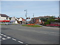
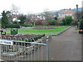
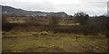
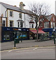
Photos of LL19 9AT


Area Information
LL19 9AT is a small residential cluster in north Wales, nestled in a quiet, low-density setting. With a population of just 1,328, it offers a close-knit community feel, where daily life is shaped by proximity to local amenities and natural surroundings. The area’s compact size means residents are likely to know their neighbours, though the small footprint also means limited housing options. Its location near Prestatyn and Rhyl provides access to larger towns without the congestion of urban centres. The area’s appeal lies in its balance of tranquillity and practical connectivity, with railway stations within reach and a range of retail outlets nearby. While not a commuter hub, it suits those seeking a slower pace of life, with homes predominantly in the form of detached or semi-detached properties. The median age of 47 suggests a stable, mature population, many of whom may be long-term residents. For buyers, this postcode represents a niche market, where the focus is on quality of life over scale.
- Area Type
- Postcode
- Area Size
- Not available
- Population
- 1328
- Population Density
- 2131 people/km²
The property market in LL19 9AT is characterised by a 45% home ownership rate, suggesting that nearly half of the housing stock is rented. Given the area’s small size and the prevalence of houses as the primary accommodation type, this hints at a modest, family-focused market. The limited number of properties means competition for buyers could be keen, particularly for those seeking single-family homes. The lack of high-rise or multi-unit developments implies a focus on traditional, low-density housing. For buyers, this area may appeal to those prioritising space and privacy over proximity to major cities, though the small scale of the market means options are constrained. Proximity to Prestatyn and Rhyl railway stations adds value for commuters, but the area’s appeal remains tied to its quiet, residential character.
House Prices in LL19 9AT
No properties found in this postcode.
Energy Efficiency in LL19 9AT
The lifestyle in LL19 9AT is shaped by its proximity to retail and transport hubs. Within practical reach are five retail outlets, including Aldi Prestatyn, Iceland Prestatyn, and Lidl Parc, offering everyday shopping convenience. The area’s railway stations at Prestatyn and Rhyl provide access to broader networks, enabling travel to nearby towns or cities. While the data does not mention parks or leisure facilities, the presence of retail and transport options suggests a focus on practicality over leisure. The small community size may mean that social life is centred around local amenities or nearby towns. For residents, the balance of retail access and transport connectivity supports a self-sufficient lifestyle, though those seeking extensive recreational facilities may need to look beyond the immediate area.
Amenities
Schools
The nearest school to LL19 9AT is Ysgol Penmorfa, categorised as an ‘other’ type in the data. While no Ofsted rating is provided, the presence of a single school suggests a limited selection for families. The absence of additional schools in the data means no analysis of school diversity or performance can be made. For parents, the availability of a local school is a key consideration, though the lack of further details on its curriculum or facilities may require direct inquiry. The school’s type and rating are not specified, so prospective buyers should verify this independently. The area’s small size may mean that families rely on nearby towns for secondary education or specialist provisions.
| Rank | School | Type | Entry gender | Ages |
|---|
Explore more schools in this area
Go to Schools tabDemographics
The population of LL19 9AT is predominantly adults aged 30–64, with a median age of 47. This suggests a community of established professionals and families, rather than a younger demographic. Home ownership stands at 45%, indicating a mix of owner-occupied and rental properties, though the exact proportion of renters is not specified. The area’s accommodation is largely composed of houses, which aligns with the presence of a mature, settled population. The predominant ethnic group is White, though no further breakdown of diversity is provided. The absence of deprivation data means no direct commentary can be made on economic conditions, but the age profile and housing stock imply a relatively stable, middle-income community. The low population density and focus on single-family homes further reinforce this picture of a quiet, family-oriented area.
Household Size
Accommodation Type
Tenure
Ethnic Group
Religion
Household Composition
Age
Household Deprivation
NS-SEC
Explore more demographic insights in this area
Go to Demographics tabPlanning
Planning Constraints
- Flood RiskPremium
- Ramsar Wetland SitesPremium
- Area of Outstanding Natural BeautyPremium
- Protected Nature ReservePremium
- Protected WoodlandPremium
- Crime RiskPremium