Area Overview for LL19 7ZT
Photos of LL19 7ZT


Area Information
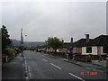
Living in LL19 7ZT means being part of a small, tightly knit residential cluster in north Wales, with a population of just over 2,600 people. This area is characterised by its quiet, suburban feel, with homes predominantly set in traditional house formats. The community is largely composed of adults aged 30–64, reflecting a mature demographic with strong ties to local amenities. Proximity to Prestatyn and Rhyl railway stations offers easy access to larger towns and coastal attractions, while nearby shops such as Co-op Prestatyn and Lidl Parc provide daily essentials. The area’s digital connectivity is robust, with broadband rated excellent, though mobile coverage is fair. This makes it suitable for remote workers and families prioritising reliable internet. LL19 7ZT is ideal for those seeking a stable, low-risk environment with a balance of convenience and tranquillity, though its small size means buyers should consider nearby areas for broader options.
- Area Type
- Postcode
- Area Size
- Not available
- Population
- 2635
- Population Density
- 4258 people/km²
LL19 7ZT is a largely owner-occupied area, with 69% of homes owned by residents rather than rented. The housing stock is dominated by houses, which is typical of smaller, rural or semi-rural postcode areas. This suggests a focus on family homes and long-term residency, with limited availability of flats or apartments. The small size of the area means the property market is likely to be niche, with buyers needing to look beyond LL19 7ZT itself for a broader selection. For those seeking a home here, the emphasis on house ownership and traditional housing styles may appeal to buyers prioritising stability and space, though the market’s limited scale could mean fewer options for specific preferences.
House Prices in LL19 7ZT
No properties found in this postcode.
Energy Efficiency in LL19 7ZT
Residents of LL19 7ZT have access to a range of local amenities within practical reach. The nearby Co-op Prestatyn, Spar, and Lidl Parc provide essential shopping, while the two railway stations—Prestatyn and Rhyl—offer transport links to broader regional networks. Though the area is small, these amenities contribute to a convenient lifestyle, supporting daily errands and commuting needs. The presence of retail outlets and rail connectivity suggests the area is well-served for practical living, though larger leisure or entertainment options would require travel to nearby towns. The combination of local shops and rail access makes LL19 7ZT suitable for those prioritising accessibility over sprawling urban facilities.
Amenities
Schools
| Rank | School | Type | Entry gender | Ages |
|---|
Explore more schools in this area
Go to Schools tabDemographics
The population of LL19 7ZT has a median age of 47, with the majority of residents falling within the 30–64 age range. This suggests a community of established professionals and families, rather than a younger or elderly demographic. Home ownership is high at 69%, indicating a strong preference for long-term residency. The area is predominantly composed of houses, reflecting a traditional housing stock with limited high-density development. The predominant ethnic group is White, though no specific data on diversity or deprivation is provided. The age profile and ownership rates suggest a stable, low-turnover community, with residents likely prioritising security and familiarity over transient living.
Household Size
Accommodation Type
Tenure
Ethnic Group
Religion
Household Composition
Age
Household Deprivation
NS-SEC
Explore more demographic insights in this area
Go to Demographics tabPlanning
Planning Constraints
- Flood RiskPremium
- Ramsar Wetland SitesPremium
- Area of Outstanding Natural BeautyPremium
- Protected Nature ReservePremium
- Protected WoodlandPremium
- Crime RiskPremium