Area Overview for LL19 7LG
Photos of LL19 7LG


Area Information
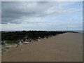
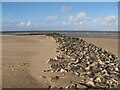
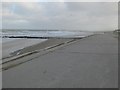
Living in LL19 7LG means being part of a tightly knit residential cluster in north Wales. The area covers 29.2 hectares and is home to 1,157 people, creating a compact community with a population density of 483 people per square kilometre. This small postcode area is characterised by its low-rise housing and proximity to nearby towns, offering a blend of rural tranquillity and accessible amenities. Daily life here is shaped by a mature population, with a median age of 47, and a strong emphasis on home ownership. The area’s size and population suggest a quiet, stable environment where neighbours are likely to know one another. While it lacks large-scale infrastructure, its proximity to Prestatyn and Rhyl provides access to shops, transport, and services. Residents benefit from excellent broadband connectivity, though mobile coverage is moderate. For those seeking a peaceful, community-focused lifestyle with practical access to nearby towns, LL19 7LG offers a distinct alternative to larger urban centres.
- Area Type
- Postcode
- Area Size
- 29.2 hectares
- Population
- 1157
- Population Density
- 483 people/km²
The property market in LL19 7LG is dominated by owner-occupied homes, with 63% of properties owned outright by residents. This high rate of home ownership suggests a stable, long-term community with limited rental activity. The area’s housing stock is primarily composed of houses, reflecting a preference for detached or semi-detached properties over flats or apartments. Given the small size of the postcode and its residential focus, the market is likely to be niche, with limited inventory and fewer new developments. Buyers should consider that the area’s compact nature means properties are likely to be close to one another, with little scope for expansion. For those seeking a home in a quiet, established neighbourhood, LL19 7LG offers a mix of traditional housing styles, though the lack of commercial or industrial land use may limit future growth.
House Prices in LL19 7LG
No properties found in this postcode.
Energy Efficiency in LL19 7LG
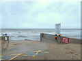
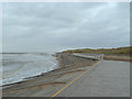
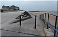
Daily life in LL19 7LG is shaped by its proximity to nearby towns, offering a mix of local and regional amenities. Within practical reach are M&S Prestatyn, Tesco Prestatyn, and Spar, providing access to groceries, clothing, and convenience stores. The area’s small size means residents are likely to rely on these nearby shops for their needs. While there is no mention of parks or leisure facilities within the postcode itself, the surrounding towns offer more extensive options. The presence of two railway stations and a range of retail outlets suggests a lifestyle that balances local convenience with the ability to access larger services in Prestatyn and Rhyl. This makes LL19 7LG suitable for those who value a quiet, residential environment without sacrificing access to essential amenities.
Amenities
Schools
The nearest school to LL19 7LG is Bodnant Infants School, which serves early years education. No further details about its Ofsted rating or curriculum are available in the data. The presence of a primary school suggests that families with young children can access local education without long commutes. However, the absence of secondary schools or additional educational institutions within the area means parents may need to look to nearby towns like Prestatyn or Rhyl for secondary education. The single school listed highlights the limited educational infrastructure in LL19 7LG itself, though the proximity to larger settlements ensures broader options. For families prioritising convenience, this school’s location may be a key consideration in deciding whether to settle in the area.
| Rank | School | Type | Entry gender | Ages |
|---|
Explore more schools in this area
Go to Schools tabDemographics
The community in LL19 7LG is predominantly composed of adults aged 30–64, reflecting a mature demographic with a median age of 47. Home ownership is high, with 63% of residents living in properties they own, compared to rental occupancy. The area is largely residential, with houses making up the majority of accommodation types. The predominant ethnic group is White, though no further breakdown of diversity is provided. This demographic profile suggests a stable, long-term resident base with established family networks. The population density of 483 people per square kilometre indicates a moderately sized community, where social interactions are likely to be frequent. The absence of specific data on deprivation or income levels means quality of life can only be inferred from the availability of services and amenities. The mix of age groups and home ownership suggests a balance between retirees and working-age households.
Household Size
Accommodation Type
Tenure
Ethnic Group
Religion
Household Composition
Age
Household Deprivation
NS-SEC
Explore more demographic insights in this area
Go to Demographics tabPlanning
Planning Constraints
- Flood RiskPremium
- Ramsar Wetland SitesPremium
- Area of Outstanding Natural BeautyPremium
- Protected Nature ReservePremium
- Protected WoodlandPremium
- Crime RiskPremium