Area Overview for LL19 7DJ
Photos of LL19 7DJ
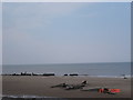
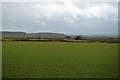
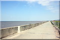
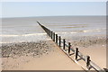

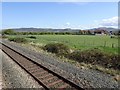
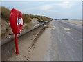
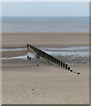

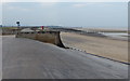
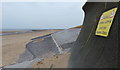
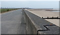
42 photos from this area
Area Information
Key information about the LL19 7DJ including its size, population, and administrative classification.
- Area Type
- Postcode
- Area Size
- 1.1 hectares
- Population
- 1641
- Population Density
- 2134 people/km²
House Prices in LL19 7DJ
18
Properties
£131,961
Average Sold Price
£56,500
Lowest Price
£216,000
Highest Price
Showing 18 properties
| Address | Type | Beds | Baths | Last Sale Price | Last Sale Date | |
|---|---|---|---|---|---|---|
| 81 Garnett Drive, Prestatyn, LL19 7DJ | Bungalow | 2 | 1 | £215,000 | Aug 2025 | |
| 95 Garnett Drive, Prestatyn, LL19 7DJ | Bungalow | 2 | 1 | £216,000 | Aug 2023 | |
| 107 Garnett Drive, Prestatyn, LL19 7DJ | Bungalow | 2 | 1 | £175,000 | Nov 2022 | |
| 85 Garnett Drive, Prestatyn, LL19 7DJ | Bungalow | 2 | 1 | £170,000 | Apr 2022 | |
| 93 Garnett Drive, Prestatyn, LL19 7DJ | Bungalow | - | - | £175,000 | Sep 2021 | |
| 91 Garnett Drive, Prestatyn, LL19 7DJ | Bungalow | 2 | 1 | £146,000 | Sep 2019 | |
| 105 Garnett Drive, Prestatyn, LL19 7DJ | Bungalow | 2 | - | £128,000 | Oct 2013 | |
| 101 Garnett Drive, Prestatyn, LL19 7DJ | Detached | 2 | - | £128,950 | Mar 2013 | |
| 97 Garnett Drive, Prestatyn, LL19 7DJ | Detached | - | - | £125,000 | Jan 2008 | |
| 99 Garnett Drive, Prestatyn, LL19 7DJ | Bungalow | 2 | 1 | £95,000 | Apr 2004 |
Page 1 of 2
Energy Efficiency in LL19 7DJ
Amenities
Schools
| Rank | School | Type | Entry gender | Ages |
|---|
Explore more schools in this area
Go to Schools tabDemographics
Household Size
Two person
most common
Accommodation Type
Houses
most common
Tenure
81
majority
Ethnic Group
White
most common
Religion
N/A
most common
Household Composition
N/A
most common
Age
47
median
Elderly (65+ years)
most common
Household Deprivation
N/A
with no deprivation
NS-SEC
24
in Lower managerial occupations
Explore more demographic insights in this area
Go to Demographics tabPlanning
Planning Constraints
- Flood RiskPremium
- Ramsar Wetland SitesPremium
- Area of Outstanding Natural BeautyPremium
- Protected Nature ReservePremium
- Protected WoodlandPremium
- Crime RiskPremium