Area Overview for LL18 6BS
Photos of LL18 6BS

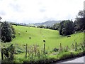
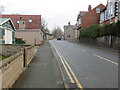
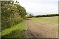
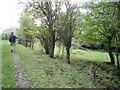
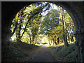
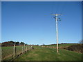
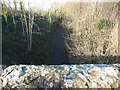
24 photos from this area
Area Information
Key information about the LL18 6BS including its size, population, and administrative classification.
- Area Type
- Postcode
- Area Size
- 72.1 hectares
- Population
- 1282
- Population Density
- 563 people/km²
House Prices in LL18 6BS
53
Properties
£164,321
Average Sold Price
£22,000
Lowest Price
£345,000
Highest Price
Showing 53 properties
| Address | Type | Beds | Baths | Last Sale Price | Last Sale Date | |
|---|---|---|---|---|---|---|
| Killavey, Newmarket Road, Dyserth, Rhyl, LL18 6BS | Bungalow | - | - | £345,000 | Apr 2024 | |
| Uplands, Newmarket Road, Dyserth, Rhyl, LL18 6BS | house | - | - | £160,000 | Apr 2022 | |
| Inglewood, Newmarket Road, Dyserth, Rhyl, LL18 6BS | Bungalow | 3 | 1 | £270,000 | Jan 2022 | |
| Eskdale, Newmarket Road, Dyserth, Rhyl, LL18 6BS | Semi-detached | 3 | - | £150,000 | Jun 2021 | |
| Homestead, Newmarket Road, Dyserth, Rhyl, LL18 6BS | house | - | - | £147,000 | Aug 2018 | |
| Holmlea, Newmarket Road, Dyserth, Rhyl, LL18 6BS | Semi-detached | 3 | 1 | £118,000 | Oct 2017 | |
| The Glen, Newmarket Road, Dyserth, Rhyl, LL18 6BS | Detached | 5 | 5 | £260,000 | Mar 2015 | |
| Rose Mount, Newmarket Road, Dyserth, Rhyl, LL18 6BS | Bungalow | - | - | £110,000 | Nov 2009 | |
| Wayside, Newmarket Road, Dyserth, Rhyl, LL18 6BS | Bungalow | - | - | £140,000 | May 2007 | |
| Fairhaven, Newmarket Road, Dyserth, Rhyl, LL18 6BS | Bungalow | - | - | £186,500 | Nov 2002 |
Page 1 of 6
Energy Efficiency in LL18 6BS
Amenities
Schools
| Rank | School | Type | Entry gender | Ages |
|---|
Explore more schools in this area
Go to Schools tabDemographics
Household Size
Two person
most common
Accommodation Type
Houses
most common
Tenure
84
majority
Ethnic Group
White
most common
Religion
N/A
most common
Household Composition
N/A
most common
Age
47
median
Adults (30-64 years)
most common
Household Deprivation
N/A
with no deprivation
NS-SEC
40
in Lower managerial occupations
Explore more demographic insights in this area
Go to Demographics tabPlanning
Planning Constraints
- Flood RiskPremium
- Ramsar Wetland SitesPremium
- Area of Outstanding Natural BeautyPremium
- Protected Nature ReservePremium
- Protected WoodlandPremium
- Crime RiskPremium