Area Overview for LL18 5AB
Photos of LL18 5AB
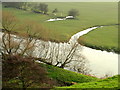
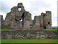
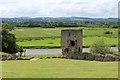
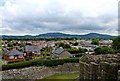
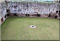
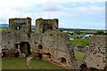
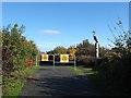
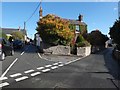
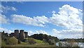
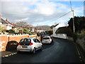
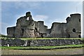
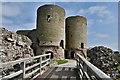
85 photos from this area
Area Information
Key information about the LL18 5AB including its size, population, and administrative classification.
- Area Type
- Postcode
- Area Size
- 4.1 hectares
- Population
- 1426
- Population Density
- 809 people/km²
House Prices in LL18 5AB
12
Properties
£152,490
Average Sold Price
£43,950
Lowest Price
£330,000
Highest Price
Showing 12 properties
| Address | Type | Beds | Baths | Last Sale Price | Last Sale Date | |
|---|---|---|---|---|---|---|
| Derwen, 1 Castle Street, Rhuddlan, Rhyl, LL18 5AB | Detached | 2 | 1 | £170,000 | Jun 2025 | |
| Jerboa, Castle Street, Rhuddlan, Rhyl, LL18 5AB | Detached | 4 | - | £330,000 | Jan 2025 | |
| 3 Castle Street, Rhuddlan, Rhyl, LL18 5AB | Terraced | 2 | 1 | £110,000 | Jun 2015 | |
| Clwyd Villa, Castle Street, Rhuddlan, Rhyl, LL18 5AB | Detached | - | - | £108,500 | May 2002 | |
| 2 Castle Street, Rhuddlan, Rhyl, LL18 5AB | Terraced | 2 | 1 | £43,950 | Jul 2001 | |
| Bryn Castell, Castle Street, Rhuddlan, Rhyl, LL18 5AB | Detached | 4 | 1 | - | - | |
| Tower House, Castle Street, Rhuddlan, Rhyl, LL18 5AB | Detached | 4 | - | - | - | |
| Westbrook, Castle Street, Rhuddlan, Rhyl, LL18 5AB | house | - | - | - | - | |
| The Old School House, Castle Street, Rhuddlan, Rhyl, LL18 5AB | Detached | - | - | - | - | |
| Flat 1, Tower House, Castle Street, Rhuddlan, Rhyl, LL18 5AB | Flat | - | - | - | - |
Page 1 of 2
Energy Efficiency in LL18 5AB
Amenities
Schools
| Rank | School | Type | Entry gender | Ages |
|---|
Explore more schools in this area
Go to Schools tabDemographics
Household Size
One person
most common
Accommodation Type
Houses
most common
Tenure
67
majority
Ethnic Group
White
most common
Religion
N/A
most common
Household Composition
N/A
most common
Age
47
median
Adults (30-64 years)
most common
Household Deprivation
N/A
with no deprivation
NS-SEC
31
in Lower managerial occupations
Explore more demographic insights in this area
Go to Demographics tabPlanning
Planning Constraints
- Flood RiskPremium
- Ramsar Wetland SitesPremium
- Area of Outstanding Natural BeautyPremium
- Protected Nature ReservePremium
- Protected WoodlandPremium
- Crime RiskPremium