Area Overview for LL18 4RS
Photos of LL18 4RS
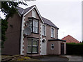
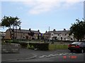
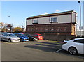
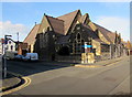
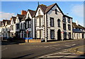
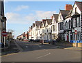
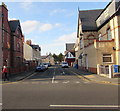
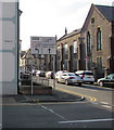
68 photos from this area
Area Information
Key information about the LL18 4RS including its size, population, and administrative classification.
- Area Type
- Postcode
- Area Size
- 3.8 hectares
- Population
- 1796
- Population Density
- 4442 people/km²
House Prices in LL18 4RS
22
Properties
£136,032
Average Sold Price
£40,000
Lowest Price
£335,000
Highest Price
Showing 22 properties
| Address | Type | Beds | Baths | Last Sale Price | Last Sale Date | |
|---|---|---|---|---|---|---|
| 50 Madryn Avenue, Rhyl, LL18 4RS | house | - | - | £335,000 | Apr 2025 | |
| 32 Madryn Avenue, Rhyl, LL18 4RS | house | - | - | £230,000 | Apr 2022 | |
| 44 Madryn Avenue, Rhyl, LL18 4RS | Semi-detached | 3 | 1 | £155,000 | Sep 2020 | |
| 48 Madryn Avenue, Rhyl, LL18 4RS | Semi-detached | 3 | 1 | £117,000 | Oct 2018 | |
| 16 Madryn Avenue, Rhyl, LL18 4RS | Semi-detached | 3 | 1 | £155,000 | May 2018 | |
| 30 Madryn Avenue, Rhyl, LL18 4RS | house | - | - | £140,000 | Dec 2015 | |
| 12 Madryn Avenue, Rhyl, LL18 4RS | house | - | - | £149,000 | Jun 2015 | |
| 36 Madryn Avenue, Rhyl, LL18 4RS | Detached | - | - | £141,500 | Jun 2007 | |
| 28 Madryn Avenue, Rhyl, LL18 4RS | Semi-detached | - | - | £160,000 | Jan 2006 | |
| 10 Madryn Avenue, Rhyl, LL18 4RS | Semi-detached | - | - | £129,950 | Apr 2004 |
Page 1 of 3
Energy Efficiency in LL18 4RS
Amenities
Schools
| Rank | School | Type | Entry gender | Ages |
|---|
Explore more schools in this area
Go to Schools tabDemographics
Household Size
Family (3-5 people)
most common
Accommodation Type
Houses
most common
Tenure
66
majority
Ethnic Group
White
most common
Religion
N/A
most common
Household Composition
N/A
most common
Age
47
median
Adults (30-64 years)
most common
Household Deprivation
N/A
with no deprivation
NS-SEC
21
in Lower managerial occupations
Explore more demographic insights in this area
Go to Demographics tabPlanning
Planning Constraints
- Flood RiskPremium
- Ramsar Wetland SitesPremium
- Area of Outstanding Natural BeautyPremium
- Protected Nature ReservePremium
- Protected WoodlandPremium
- Crime RiskPremium