Area Overview for LL18 4JL
Photos of LL18 4JL
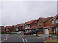
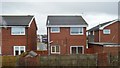
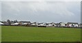
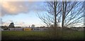
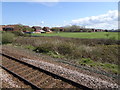
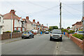
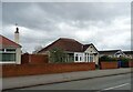
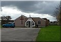
24 photos from this area
Area Information
Key information about the LL18 4JL including its size, population, and administrative classification.
- Area Type
- Postcode
- Area Size
- 3.0 hectares
- Population
- 1332
- Population Density
- 3803 people/km²
House Prices in LL18 4JL
8
Properties
£147,581
Average Sold Price
£49,700
Lowest Price
£220,000
Highest Price
Showing 8 properties
| Address | Type | Beds | Baths | Last Sale Price | Last Sale Date | |
|---|---|---|---|---|---|---|
| 12 Cherry Tree Walk, Rhyl, LL18 4JL | Bungalow | 3 | 2 | £200,000 | May 2024 | |
| 8 Cherry Tree Walk, Rhyl, LL18 4JL | Bungalow | 2 | 1 | £220,000 | Jul 2023 | |
| 6 Cherry Tree Walk, Rhyl, LL18 4JL | Bungalow | - | - | £160,000 | May 2022 | |
| 14 Cherry Tree Walk, Rhyl, LL18 4JL | Bungalow | 3 | 1 | £160,000 | Sep 2015 | |
| 16 Cherry Tree Walk, Rhyl, LL18 4JL | Bungalow | 3 | 1 | £179,950 | Nov 2006 | |
| 10 Cherry Tree Walk, Rhyl, LL18 4JL | Detached | - | - | £156,000 | Apr 2005 | |
| 4 Cherry Tree Walk, Rhyl, LL18 4JL | Bungalow | - | - | £55,000 | Aug 2003 | |
| 2 Cherry Tree Walk, Rhyl, LL18 4JL | Detached | 2 | 1 | £49,700 | Nov 1997 |
Energy Efficiency in LL18 4JL
Amenities
Schools
| Rank | School | Type | Entry gender | Ages |
|---|
Explore more schools in this area
Go to Schools tabDemographics
Household Size
One person
most common
Accommodation Type
Houses
most common
Tenure
68
majority
Ethnic Group
White
most common
Religion
N/A
most common
Household Composition
N/A
most common
Age
47
median
Adults (30-64 years)
most common
Household Deprivation
N/A
with no deprivation
NS-SEC
25
in Lower managerial occupations
Explore more demographic insights in this area
Go to Demographics tabPlanning
Planning Constraints
- Flood RiskPremium
- Ramsar Wetland SitesPremium
- Area of Outstanding Natural BeautyPremium
- Protected Nature ReservePremium
- Protected WoodlandPremium
- Crime RiskPremium