Area Overview for LL18 4GH
Photos of LL18 4GH
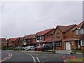
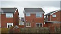
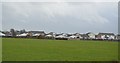
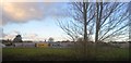
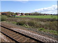
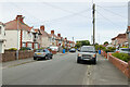
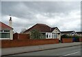
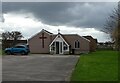
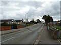
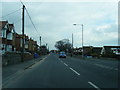
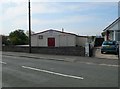
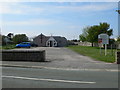
24 photos from this area
Area Information
Key information about the LL18 4GH including its size, population, and administrative classification.
- Area Type
- Postcode
- Area Size
- 5570 m²
- Population
- 1335
- Population Density
- 4797 people/km²
House Prices in LL18 4GH
13
Properties
£110,404
Average Sold Price
£45,450
Lowest Price
£183,000
Highest Price
Showing 13 properties
| Address | Type | Beds | Baths | Last Sale Price | Last Sale Date | |
|---|---|---|---|---|---|---|
| 7 Aspen Walk, Rhyl, LL18 4GH | house | - | - | £183,000 | Jul 2023 | |
| 2 Aspen Walk, Rhyl, LL18 4GH | Detached | 3 | 2 | £165,000 | Dec 2018 | |
| 6 Aspen Walk, Rhyl, LL18 4GH | Detached | 3 | 3 | £165,000 | Aug 2018 | |
| 12 Aspen Walk, Rhyl, LL18 4GH | house | - | - | £148,000 | Sep 2015 | |
| 5 Aspen Walk, Rhyl, LL18 4GH | Detached | 3 | - | £145,000 | Jun 2014 | |
| 8 Aspen Walk, Rhyl, LL18 4GH | Semi-detached | 3 | 2 | £109,000 | Apr 2013 | |
| 9 Aspen Walk, Rhyl, LL18 4GH | house | - | - | £125,000 | Sep 2010 | |
| 4 Aspen Walk, Rhyl, LL18 4GH | Semi-detached | - | - | £72,000 | Jul 2003 | |
| 3 Aspen Walk, Rhyl, LL18 4GH | Semi-detached | - | - | £69,950 | Sep 2002 | |
| 11 Aspen Walk, Rhyl, LL18 4GH | Detached | - | - | £57,950 | Sep 1999 |
Page 1 of 2
Energy Efficiency in LL18 4GH
Amenities
Schools
| Rank | School | Type | Entry gender | Ages |
|---|
Explore more schools in this area
Go to Schools tabDemographics
Household Size
Family (3-5 people)
most common
Accommodation Type
Houses
most common
Tenure
80
majority
Ethnic Group
White
most common
Religion
N/A
most common
Household Composition
N/A
most common
Age
47
median
Adults (30-64 years)
most common
Household Deprivation
N/A
with no deprivation
NS-SEC
29
in Lower managerial occupations
Explore more demographic insights in this area
Go to Demographics tabPlanning
Planning Constraints
- Flood RiskPremium
- Ramsar Wetland SitesPremium
- Area of Outstanding Natural BeautyPremium
- Protected Nature ReservePremium
- Protected WoodlandPremium
- Crime RiskPremium