Area Overview for LL18 4ET
Photos of LL18 4ET
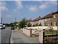
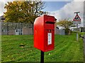
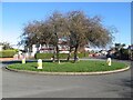
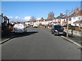
5 photos from this area
Area Information
Key information about the LL18 4ET including its size, population, and administrative classification.
- Area Type
- Postcode
- Area Size
- 9383 m²
- Population
- 1304
- Population Density
- 5104 people/km²
House Prices in LL18 4ET
20
Properties
£103,160
Average Sold Price
£40,000
Lowest Price
£164,000
Highest Price
Showing 20 properties
| Address | Type | Beds | Baths | Last Sale Price | Last Sale Date | |
|---|---|---|---|---|---|---|
| Ty Ffydd, 33 Trellewelyn Road, Rhyl, LL18 4ET | house | - | - | £164,000 | Aug 2022 | |
| 38 Trellewelyn Road, Rhyl, LL18 4ET | Bungalow | 2 | - | £135,000 | Jul 2021 | |
| 35 Trellewelyn Road, Rhyl, LL18 4ET | Semi-detached | 3 | 1 | £141,000 | Aug 2019 | |
| 32 Trellewelyn Road, Rhyl, LL18 4ET | Bungalow | 2 | - | £126,000 | Dec 2016 | |
| 34 Trellewelyn Road, Rhyl, LL18 4ET | Bungalow | - | - | £86,000 | Jun 2015 | |
| 44A Trellewelyn Road, Rhyl, LL18 4ET | Bungalow | 2 | - | £110,000 | Nov 2014 | |
| 44 Trellewelyn Road, Rhyl, LL18 4ET | Detached | - | - | £104,000 | Sep 2004 | |
| 40 Trellewelyn Road, Rhyl, LL18 4ET | Bungalow | 2 | 1 | £63,000 | Aug 2003 | |
| 36 Trellewelyn Road, Rhyl, LL18 4ET | Detached | - | - | £40,000 | Mar 2002 | |
| 37 Trellewelyn Road, Rhyl, LL18 4ET | Semi-detached | - | - | £62,600 | Apr 2000 |
Page 1 of 2
Energy Efficiency in LL18 4ET
Amenities
Schools
| Rank | School | Type | Entry gender | Ages |
|---|
Explore more schools in this area
Go to Schools tabDemographics
Household Size
Two person
most common
Accommodation Type
Houses
most common
Tenure
74
majority
Ethnic Group
White
most common
Religion
N/A
most common
Household Composition
N/A
most common
Age
47
median
Adults (30-64 years)
most common
Household Deprivation
N/A
with no deprivation
NS-SEC
23
in Lower managerial occupations
Explore more demographic insights in this area
Go to Demographics tabPlanning
Planning Constraints
- Flood RiskPremium
- Ramsar Wetland SitesPremium
- Area of Outstanding Natural BeautyPremium
- Protected Nature ReservePremium
- Protected WoodlandPremium
- Crime RiskPremium