Area Overview for LL18 3UB
Photos of LL18 3UB
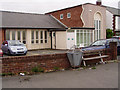
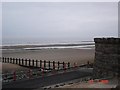
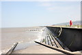
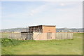
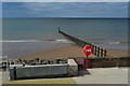
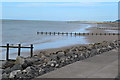
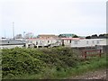
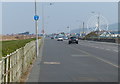
57 photos from this area
Area Information
Key information about the LL18 3UB including its size, population, and administrative classification.
- Area Type
- Postcode
- Area Size
- 1.9 hectares
- Population
- 1627
- Population Density
- 3120 people/km²
House Prices in LL18 3UB
8
Properties
£98,625
Average Sold Price
£33,500
Lowest Price
£175,000
Highest Price
Showing 8 properties
| Address | Type | Beds | Baths | Last Sale Price | Last Sale Date | |
|---|---|---|---|---|---|---|
| 24 Molineaux Road, Rhyl, LL18 3UB | Bungalow | 3 | 1 | £166,000 | Aug 2023 | |
| 23 Molineaux Road, Rhyl, LL18 3UB | Bungalow | 3 | 1 | £175,000 | Mar 2023 | |
| 19 Molineaux Road, Rhyl, LL18 3UB | Bungalow | 3 | 1 | £120,000 | Aug 2017 | |
| 20 Molineaux Road, Rhyl, LL18 3UB | Bungalow | 2 | - | £85,000 | Mar 2015 | |
| 26 Molineaux Road, Rhyl, LL18 3UB | Bungalow | - | - | £85,000 | Oct 2013 | |
| 25 Molineaux Road, Rhyl, LL18 3UB | Bungalow | 3 | 1 | £85,000 | Sep 2003 | |
| 22 Molineaux Road, Rhyl, LL18 3UB | Bungalow | - | - | £33,500 | Dec 1998 | |
| 21 Molineaux Road, Rhyl, LL18 3UB | Detached | - | - | £39,500 | Nov 1996 |
Energy Efficiency in LL18 3UB
Amenities
Schools
| Rank | School | Type | Entry gender | Ages |
|---|
Explore more schools in this area
Go to Schools tabDemographics
Household Size
One person
most common
Accommodation Type
Flats
most common
Tenure
48
majority
Ethnic Group
White
most common
Religion
N/A
most common
Household Composition
N/A
most common
Age
47
median
Elderly (65+ years)
most common
Household Deprivation
N/A
with no deprivation
NS-SEC
20
in Lower managerial occupations
Explore more demographic insights in this area
Go to Demographics tabPlanning
Planning Constraints
- Flood RiskPremium
- Ramsar Wetland SitesPremium
- Area of Outstanding Natural BeautyPremium
- Protected Nature ReservePremium
- Protected WoodlandPremium
- Crime RiskPremium