Area Overview for LL18 2PS
Photos of LL18 2PS
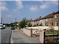
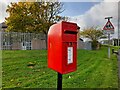
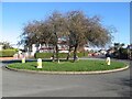
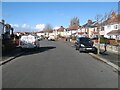
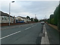
5 photos from this area
Area Information
Key information about the LL18 2PS including its size, population, and administrative classification.
- Area Type
- Postcode
- Area Size
- 6002 m²
- Population
- 1920
- Population Density
- 4495 people/km²
House Prices in LL18 2PS
15
Properties
£170,533
Average Sold Price
£59,950
Lowest Price
£305,000
Highest Price
Showing 15 properties
| Address | Type | Beds | Baths | Last Sale Price | Last Sale Date | |
|---|---|---|---|---|---|---|
| 70 Rhuddlan Road, Rhyl, LL18 2PS | Retail | 3 | 2 | £238,500 | Oct 2022 | |
| 64 Rhuddlan Road, Rhyl, LL18 2PS | house | - | - | £305,000 | Sep 2022 | |
| 80 Rhuddlan Road, Rhyl, LL18 2PS | house | - | - | £268,000 | Aug 2022 | |
| 76 Rhuddlan Road, Rhyl, LL18 2PS | Detached | 3 | 1 | £160,000 | Dec 2021 | |
| 78 Rhuddlan Road, Rhyl, LL18 2PS | house | - | - | £220,000 | Jun 2021 | |
| 66 Rhuddlan Road, Rhyl, LL18 2PS | Semi-detached | 3 | 1 | £155,000 | Nov 2018 | |
| 82 Rhuddlan Road, Rhyl, LL18 2PS | Flat | - | - | £155,000 | Jan 2007 | |
| 62 Rhuddlan Road, Rhyl, LL18 2PS | Detached | - | - | £170,000 | Jul 2006 | |
| 72 Rhuddlan Road, Rhyl, LL18 2PS | Semi-detached | - | - | £159,950 | Apr 2006 | |
| 86 Rhuddlan Road, Rhyl, LL18 2PS | Flat | 2 | - | £75,000 | Jun 2004 |
Page 1 of 2
Energy Efficiency in LL18 2PS
Amenities
Schools
| Rank | School | Type | Entry gender | Ages |
|---|
Explore more schools in this area
Go to Schools tabDemographics
Household Size
Two person
most common
Accommodation Type
Houses
most common
Tenure
81
majority
Ethnic Group
White
most common
Religion
N/A
most common
Household Composition
N/A
most common
Age
47
median
Adults (30-64 years)
most common
Household Deprivation
N/A
with no deprivation
NS-SEC
26
in Lower managerial occupations
Explore more demographic insights in this area
Go to Demographics tabPlanning
Planning Constraints
- Flood RiskPremium
- Ramsar Wetland SitesPremium
- Area of Outstanding Natural BeautyPremium
- Protected Nature ReservePremium
- Protected WoodlandPremium
- Crime RiskPremium