Area Overview for LL18 1SX
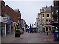
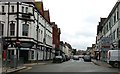
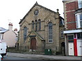
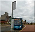
Photos of LL18 1SX


Area Information
LL18 1SX is a small residential postcode area in Wales, home to around 1,670 people. It is a compact cluster of properties, likely centred around a single neighbourhood or village. The area’s demographic profile suggests a mature community, with a median age of 47 and the majority of residents aged between 30 and 64. This hints at a stable, possibly family-oriented population, though the low home ownership rate of 19% suggests a higher proportion of renters. The area’s proximity to rail networks and retail amenities makes it practical for daily life, while its low flood risk and absence of environmental constraints indicate a straightforward living environment. Residents benefit from proximity to three railway stations, including Rhyl and Prestatyn, which connect to broader regional networks. The area’s small size means amenities are likely concentrated within walking or short driving distance, though the limited data suggests a focus on basic retail and transport links rather than extensive leisure options.
- Area Type
- Postcode
- Area Size
- Not available
- Population
- 1670
- Population Density
- 5050 people/km²
The property market in LL18 1SX is characterised by a low home ownership rate of 19%, suggesting that the majority of the housing stock is rented rather than owner-occupied. The accommodation type is predominantly flats, which may indicate a focus on smaller, practical living spaces. This profile is typical of areas with limited housing diversity, where flats might be more common due to land constraints or historical development patterns. For buyers, this means the area is unlikely to be a strong market for long-term investment, as demand may be driven by renters rather than homeowners. The small size of the postcode area implies that property options are limited, and buyers should consider the broader surrounding region for more choices. The lack of data on property prices or recent transactions means it is difficult to assess market trends, but the low home ownership rate suggests a cautious approach for those considering purchase.
House Prices in LL18 1SX
No properties found in this postcode.
Energy Efficiency in LL18 1SX
The lifestyle in LL18 1SX is shaped by its proximity to retail and transport hubs. Nearby amenities include Heron Bryhedydd, Morrisons Bryhedydd, and Spar, offering essential shopping and convenience services. These retail options suggest a practical, community-focused approach to daily needs, though the absence of larger supermarkets or specialist stores may require trips to nearby towns. The area’s rail links to Rhyl, Prestatyn, and Abergele & Pensarn provide access to broader leisure and cultural opportunities beyond the immediate postcode. While no parks or recreational facilities are listed in the data, the presence of rail stations and retail outlets indicates a functional, accessible environment. The small size of the area means that amenities are likely concentrated, making it convenient for residents who prioritise ease of access over extensive leisure options.
Amenities
Schools
The nearest school to LL18 1SX is Northgate Preparatory School, which is categorised as an "other" type. No Ofsted rating is provided in the data, so its educational quality remains unspecified. The absence of additional schools in the area means families may need to look beyond LL18 1SX for secondary or primary education options. The single school listed suggests a limited local educational infrastructure, which could be a consideration for families prioritising proximity to schools. However, the area’s rail links to nearby towns may provide access to a wider range of educational institutions. The data does not indicate whether the school serves the entire postcode area or only a portion of it, so further local research would be necessary to confirm its reach and suitability for residents.
| Rank | School | Type | Entry gender | Ages |
|---|
Explore more schools in this area
Go to Schools tabDemographics
The population of LL18 1SX is predominantly adults aged 30–64, with a median age of 47. This suggests a community of middle-aged residents, possibly including professionals, retirees, or those in mid-career. Home ownership is low at 19%, indicating that most households are likely renters, which could reflect the area’s character as a secondary or transitional housing market. The accommodation type is primarily flats, which may cater to younger households or those seeking more compact living. The predominant ethnic group is White, though no further breakdown of diversity is provided. The absence of specific deprivation data means it is unclear how economic factors influence quality of life, but the low home ownership rate could imply limited long-term investment in property. The age profile and housing stock suggest a pragmatic, functional community rather than one defined by young families or high-end property.
Household Size
Accommodation Type
Tenure
Ethnic Group
Religion
Household Composition
Age
Household Deprivation
NS-SEC
Explore more demographic insights in this area
Go to Demographics tabPlanning
Planning Constraints
- Flood RiskPremium
- Ramsar Wetland SitesPremium
- Area of Outstanding Natural BeautyPremium
- Protected Nature ReservePremium
- Protected WoodlandPremium
- Crime RiskPremium