Area Overview for LL17 0WL
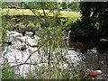
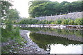
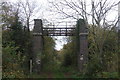
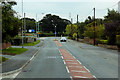
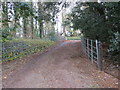
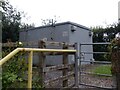
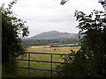
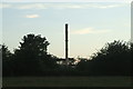
Photos of LL17 0WL
Area Information
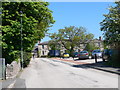
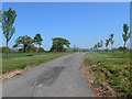
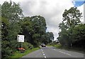
Living in LL17 0WL offers a compact, residential experience in a small cluster of homes in north Wales. With a population of 1,846 and a density of 502 people per square kilometre, the area balances proximity with space. This postcode is defined by its modest scale, where daily life unfolds within walking distance of local amenities and transport links. The community here skews towards middle-aged adults, with a median age of 47 and 72% of residents owning their homes. As a small, focused area, LL17 0WL lacks the sprawl of larger towns but provides a quiet, stable environment. Its location near Rhyl and Prestatyn railway stations connects it to broader regional networks, while nearby schools and shops cater to immediate needs. For those seeking a low-maintenance lifestyle with clear boundaries, this area offers a straightforward, uncluttered living experience. The absence of major planning constraints or environmental designations means development is unlikely to disrupt the existing character of the neighbourhood.
- Area Type
- Postcode
- Area Size
- Not available
- Population
- 1846
- Population Density
- 502 people/km²
The property market in LL17 0WL is characterised by a high rate of home ownership, with 72% of residents owning their homes. This suggests a community of long-term residents rather than a transient rental market. The predominant accommodation type is houses, which is typical for small, rural or semi-rural postcode areas. Given the area’s limited size, the housing stock is likely to be modest in scale, with properties designed for family living rather than larger, multi-unit developments. For buyers, this means a focus on individual homes rather than apartments or shared housing. The lack of planning constraints or environmental designations may make the area more attractive to those seeking a straightforward purchase without complex regulations. However, the small size of the area means that property choices are limited, and buyers should consider proximity to nearby towns for additional options.
House Prices in LL17 0WL
No properties found in this postcode.
Energy Efficiency in LL17 0WL
Residents of LL17 0WL have access to a range of nearby amenities, including five retail outlets such as Co-op St, Aldi Rhuddlan, and Spar. These shops provide essentials like groceries, fuel, and everyday items, reducing the need for long trips to larger towns. The area’s proximity to Rhyl and Prestatyn railway stations adds to its convenience, allowing easy access to broader services and entertainment. While specific parks or leisure facilities are not listed in the data, the small-scale nature of the area suggests a focus on local, low-impact amenities. The combination of retail options and rail links supports a practical lifestyle, where daily needs are met without excessive travel. This makes LL17 0WL suitable for those prioritising simplicity and accessibility over large-scale leisure opportunities.
Amenities
Schools
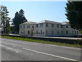
Residents of LL17 0WL have access to three schools within practical reach: St Asaph V.P. Infants, Ysgol Uwchradd Glan Clwyd, and Fairholme Prep. School. These institutions cater to different age groups, though specific Ofsted ratings are not provided in the data. The mix of school types suggests a range of educational options, from early years to primary education. For families, this proximity to schools reduces commuting time and supports a balanced lifestyle. The presence of multiple schools also indicates a stable demand for education in the area, which can be a factor in property value and community cohesion. While no performance metrics are available, the availability of schools within walking distance is a practical advantage for parents.
| Rank | School | Type | Entry gender | Ages |
|---|
Explore more schools in this area
Go to Schools tabDemographics
The demographic profile of LL17 0WL reflects a mature, settled population. With a median age of 47, the area is dominated by adults aged 30–64, making up the most common age range. Home ownership is high at 72%, indicating a stable, long-term resident base. The accommodation type is predominantly houses, which aligns with the area’s small-scale, residential nature. The predominant ethnic group is White, with no specific data provided on minority representation. The population density of 502 people per square kilometre suggests a tightly knit community where social interactions are likely to be frequent. While no deprivation data is available, the high home ownership rate and lack of planning constraints suggest a relatively low dependency on public services. This demographic structure supports a lifestyle focused on stability, with limited turnover of residents and a strong emphasis on private property.
Household Size
Accommodation Type
Tenure
Ethnic Group
Religion
Household Composition
Age
Household Deprivation
NS-SEC
Explore more demographic insights in this area
Go to Demographics tabPlanning
Planning Constraints
- Flood RiskPremium
- Ramsar Wetland SitesPremium
- Area of Outstanding Natural BeautyPremium
- Protected Nature ReservePremium
- Protected WoodlandPremium
- Crime RiskPremium