Area Overview for LL16 3HF
Photos of LL16 3HF
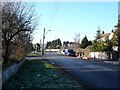
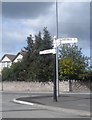
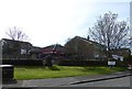
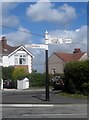
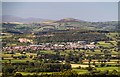
5 photos from this area
Area Information
Key information about the LL16 3HF including its size, population, and administrative classification.
- Area Type
- Postcode
- Area Size
- 1.9 hectares
- Population
- 1677
- Population Density
- 115 people/km²
House Prices in LL16 3HF
52
Properties
£123,344
Average Sold Price
£40,000
Lowest Price
£230,000
Highest Price
Showing 52 properties
| Address | Type | Beds | Baths | Last Sale Price | Last Sale Date | |
|---|---|---|---|---|---|---|
| 23 Trewen, Denbigh, LL16 3HF | Semi-detached | 3 | 1 | £210,000 | Aug 2023 | |
| 13 Trewen, Denbigh, LL16 3HF | house | 3 | 1 | £230,000 | Nov 2022 | |
| 49 Trewen, Denbigh, LL16 3HF | Bungalow | - | - | £193,500 | Dec 2021 | |
| 36 Trewen, Denbigh, LL16 3HF | Semi-detached | 3 | 1 | £147,000 | Feb 2020 | |
| 12 Trewen, Denbigh, LL16 3HF | house | - | - | £155,000 | Nov 2018 | |
| Rhyfon, 29 Trewen, Denbigh, LL16 3HF | house | - | - | £130,000 | Mar 2017 | |
| 45 Trewen, Denbigh, LL16 3HF | Semi-detached | 3 | - | £155,000 | Dec 2015 | |
| 8 Trewen, Denbigh, LL16 3HF | Semi-detached | 3 | 1 | £148,500 | Aug 2014 | |
| 52 Trewen, Denbigh, LL16 3HF | Semi-detached | 3 | - | £125,000 | Dec 2012 | |
| 14 Trewen, Denbigh, LL16 3HF | house | 3 | - | £138,000 | Sep 2012 |
Page 1 of 6
Energy Efficiency in LL16 3HF
Amenities
Schools
| Rank | School | Type | Entry gender | Ages |
|---|
Explore more schools in this area
Go to Schools tabDemographics
Household Size
One person
most common
Accommodation Type
Houses
most common
Tenure
72
majority
Ethnic Group
White
most common
Religion
N/A
most common
Household Composition
N/A
most common
Age
47
median
Adults (30-64 years)
most common
Household Deprivation
N/A
with no deprivation
NS-SEC
34
in Lower managerial occupations
Explore more demographic insights in this area
Go to Demographics tabPlanning
Planning Constraints
- Flood RiskPremium
- Ramsar Wetland SitesPremium
- Area of Outstanding Natural BeautyPremium
- Protected Nature ReservePremium
- Protected WoodlandPremium
- Crime RiskPremium