Area Overview for LL16 3EX
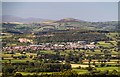
Photos of LL16 3EX
Area Information
Living in LL16 3EX offers a compact, residential experience within a small cluster of homes. With a population of 1,677 spread over 1.2 hectares, the area is densely populated but retains a close-knit character. The median age of 47 suggests a community of middle-aged adults, many of whom are likely long-term residents. This is a place where daily life is shaped by proximity to local amenities and schools, with homes predominantly owner-occupied. The area’s small size means residents are likely to know their neighbours, though the limited space also means the housing stock is finite. Proximity to Denbigh and surrounding areas ensures access to broader services, while the absence of major planning constraints allows for a straightforward living environment. For those seeking a quiet, established community with a focus on family-oriented living, LL16 3EX provides a stable base. However, its size and density mean it is best suited for those prioritising convenience over expansive outdoor spaces.
- Area Type
- Postcode
- Area Size
- 1.2 hectares
- Population
- 1677
- Population Density
- 115 people/km²
The property market in LL16 3EX is characterised by a high rate of home ownership, with 72% of residents owning their homes. This suggests a stable, long-term market rather than a transient rental-focused environment. The predominant accommodation type is houses, which is unusual for a small postcode area but indicates a focus on family-sized properties. The limited area size means the housing stock is finite, and the market is likely to be competitive for buyers seeking a permanent residence. Given the proximity to Denbigh and surrounding areas, properties here may appeal to those prioritising convenience over space. However, the lack of planning constraints such as protected landscapes or wetlands means development pressure is minimal. For buyers, this translates to a predictable market with homes that are likely to retain value. The small scale of the area also means that property searches should extend beyond LL16 3EX to nearby postcode clusters for broader options.
House Prices in LL16 3EX
No properties found in this postcode.
Energy Efficiency in LL16 3EX
The lifestyle in LL16 3EX is shaped by its proximity to retail and everyday amenities. Within practical reach are five notable retail outlets, including Morrisons Daily, Aldi Denbigh, and Lidl Denbigh, offering a range of grocery and convenience shopping options. This density of retail services reduces the need for long trips to larger centres, supporting a self-sufficient daily routine. While the area lacks explicit references to parks or leisure facilities, the presence of schools and shops suggests a focus on practicality over expansive recreational spaces. The compact nature of the area means residents can access essentials quickly, though those seeking larger green spaces or cultural amenities may need to look beyond the immediate vicinity. The combination of retail and educational facilities creates a functional, community-oriented environment where daily needs are met without significant travel.
Amenities
Schools
Residents of LL16 3EX have access to three schools within practical reach: Ysgol Y Parc Infants, Denbigh High School, and Ysgol Plas Brondyffryn. These institutions cater to different age groups, with the infants’ school serving younger children and the high school providing secondary education. The presence of both primary and secondary options within the area reduces the need for long commutes, which is a key consideration for families. The names of the schools suggest a mix of Welsh and English-medium education, reflecting the local linguistic landscape. While specific Ofsted ratings are not provided, the variety of school types indicates a range of educational choices. For parents, this proximity to schooling is a significant advantage, allowing for a balanced lifestyle that combines family needs with the convenience of local services. The small size of the area means schools are likely to be central to community life, fostering a sense of cohesion among residents.
| Rank | School | Type | Entry gender | Ages |
|---|
Explore more schools in this area
Go to Schools tabDemographics
The demographic profile of LL16 3EX is defined by a median age of 47, with the majority of residents falling into the 30-64 age range. This suggests a mature, stable population, likely with strong ties to the area. Home ownership is high, at 72%, indicating a preference for long-term residency over rental properties. The accommodation type is predominantly houses, which aligns with the area’s residential character. The predominant ethnic group is White, though no further breakdown of diversity is provided. The population density of 115 people per square kilometre reflects a moderately compact settlement, balancing privacy with community interaction. The absence of specific deprivation data means the quality of life is inferred from the availability of amenities and services. With schools, retail, and transport options nearby, the area supports a self-contained lifestyle. However, the limited population size and housing stock suggest it is not a rapidly growing or diverse community.
Household Size
Accommodation Type
Tenure
Ethnic Group
Religion
Household Composition
Age
Household Deprivation
NS-SEC
Explore more demographic insights in this area
Go to Demographics tabPlanning
Planning Constraints
- Flood RiskPremium
- Ramsar Wetland SitesPremium
- Area of Outstanding Natural BeautyPremium
- Protected Nature ReservePremium
- Protected WoodlandPremium
- Crime RiskPremium