Area Overview for LL16 3DP
Photos of LL16 3DP
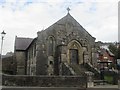
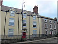
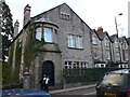
100 photos from this area
Area Information
Key information about the LL16 3DP including its size, population, and administrative classification.
- Area Type
- Postcode
- Area Size
- 2.6 hectares
- Population
- 1406
- Population Density
- 761 people/km²
House Prices in LL16 3DP
10
Properties
£160,000
Average Sold Price
£75,000
Lowest Price
£275,000
Highest Price
Showing 10 properties
| Address | Type | Beds | Baths | Last Sale Price | Last Sale Date | |
|---|---|---|---|---|---|---|
| Banwy, Rhyl Road, Denbigh, LL16 3DP | Bungalow | - | - | £275,000 | Apr 2024 | |
| Bryn Tirion, Rhyl Road, Denbigh, LL16 3DP | hotel | - | - | £130,000 | Nov 2005 | |
| Glenydd, Rhyl Road, Denbigh, LL16 3DP | Semi-detached | - | - | £75,000 | Sep 1996 | |
| Ysgol Twm O'r Nant & Housing, Ysgol Twm Or Nant, Rhyl Road, Denbigh, LL16 3DP | undefined | - | - | - | - | |
| Annexe, Tyn Fron School, Rhyl Road, Denbigh, LL16 3DP | undefined | - | - | - | - | |
| Cartref, Rhyl Road, Denbigh, LL16 3DP | Semi-detached | - | - | - | - | |
| Tyn Fron School, Rhyl Road, Denbigh, LL16 3DP | commercial | - | - | - | - | |
| Y Gelli Aur, Rhyl Road, Denbigh, LL16 3DP | Bungalow | - | - | - | - | |
| Bryngwenallt, Rhyl Road, Denbigh, LL16 3DP | Detached | - | - | - | - | |
| Ysgol Twm Or Nant, Rhyl Road, Denbigh, LL16 3DP | education | - | - | - | - |
Energy Efficiency in LL16 3DP
Amenities
Schools
| Rank | School | Type | Entry gender | Ages |
|---|
Explore more schools in this area
Go to Schools tabDemographics
Household Size
Family (3-5 people)
most common
Accommodation Type
Houses
most common
Tenure
78
majority
Ethnic Group
White
most common
Religion
N/A
most common
Household Composition
N/A
most common
Age
47
median
Adults (30-64 years)
most common
Household Deprivation
N/A
with no deprivation
NS-SEC
33
in Lower managerial occupations
Explore more demographic insights in this area
Go to Demographics tabPlanning
Planning Constraints
- Flood RiskPremium
- Ramsar Wetland SitesPremium
- Area of Outstanding Natural BeautyPremium
- Protected Nature ReservePremium
- Protected WoodlandPremium
- Crime RiskPremium