Area Overview for LL15 2EN
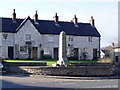
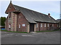
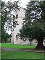
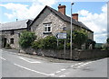
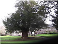
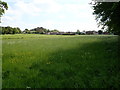
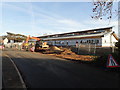
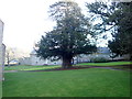
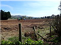
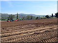
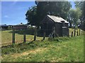
Photos of LL15 2EN

Area Information
LL15 2EN is a small, tightly knit residential cluster in north Wales, covering just 11.2 hectares and home to 2,308 residents. Its low population density of 25 people per square kilometre suggests a quiet, spacious living environment, typical of rural or semi-rural Welsh communities. The area’s compact size means it is likely to be surrounded by open countryside or smaller villages, offering a contrast to urban centres. With a median age of 47, the community is predominantly composed of adults aged 30–64, indicating a stable, mature demographic. This age profile often correlates with established households and long-term residency, contributing to a sense of continuity. The area’s character is defined by its modest scale, with homes likely to be family-oriented and rooted in local traditions. While it lacks major infrastructure, its small footprint ensures a close-knit feel, where daily life is shaped by proximity to nearby amenities and the natural surroundings. For those seeking a tranquil, low-density living environment, LL15 2EN offers a snapshot of Welsh rural life, with a focus on community and simplicity.
- Area Type
- Postcode
- Area Size
- 11.2 hectares
- Population
- 2308
- Population Density
- 25 people/km²
The property market in LL15 2EN is characterised by a high rate of home ownership (75%), with houses being the predominant accommodation type. This suggests a community where long-term residency is common, and properties are likely to be family homes rather than investment properties or rental units. The small area size of 11.2 hectares means the housing stock is limited, potentially making the market competitive for buyers seeking specific properties. The focus on houses rather than flats or apartments indicates a preference for private, spacious living, which may appeal to those prioritising outdoor space or a quieter lifestyle. However, the limited size of the area means that the immediate surroundings may hold more options for buyers. For those considering the area, the high home ownership rate suggests a stable market, though the modest number of properties could mean fewer choices. Buyers should also consider the rural context, which may influence property values and availability compared to urban centres.
House Prices in LL15 2EN
Showing 5 properties
| Address | Type | Beds | Baths | Last Sale Price | Last Sale Date | |
|---|---|---|---|---|---|---|
| Tyddyn Garreg, Eyarth To Haymakers Road, Llanfair Dyffryn Clwyd, Ruthin, LL15 2EN | Bungalow | - | - | £370,000 | Aug 2019 | |
| The Bridles, Eyarth To Haymakers Road, Llanfair Dyffryn Clwyd, Ruthin, LL15 2EN | Detached | - | - | £360,000 | Mar 2008 | |
| Llys Hywel, Eyarth To Haymakers Road, Llanfair Dyffryn Clwyd, Ruthin, LL15 2EN | Detached | - | - | £61,000 | Oct 1996 | |
| Plas Bron Dyffryn, Eyarth To Haymakers Road, Llanfair Dyffryn Clwyd, Ruthin, LL15 2EN | house | - | - | - | - | |
| Clover Bank, Eyarth To Haymakers Road, Llanfair Dyffryn Clwyd, Ruthin, LL15 2EN | Bungalow | - | - | - | - |
Energy Efficiency in LL15 2EN
The lifestyle in LL15 2EN is shaped by its proximity to retail amenities, including Co-op Ruthin, Morrisons Daily, and Tesco Ruthin, which are all within practical reach. These stores provide essential shopping options, from groceries to household goods, supporting daily convenience. The area’s small size and low population density suggest that leisure and recreational facilities may be limited to nearby villages or natural spaces, though no specific parks or leisure venues are listed in the data. The retail presence indicates a functional, community-focused environment where residents can access basic needs without long commutes. The availability of multiple supermarkets also implies a degree of economic activity, potentially supporting local employment. For those valuing self-sufficiency, the proximity to these shops reduces reliance on distant services. However, the absence of detailed information on parks or cultural amenities means that the full extent of lifestyle options remains unclear. The area’s character is likely defined by its simplicity and reliance on nearby towns for more extensive services.
Amenities
Schools
Residents of LL15 2EN have access to three schools within practical reach: Ysgol Gynradd Pentrecelyn, Ysgol Bro Elwern, and Ysgol Reoledig Llanfair D.C. All three are categorised as 'other' in the data, though no specific Ofsted ratings are provided. The presence of multiple schools suggests a range of educational options, though the exact types—such as primary, secondary, or specialist institutions—are not detailed. For families, this mix could indicate a combination of early years education, primary schooling, or alternative learning environments. However, without further information on the schools’ performance or specialisms, it is difficult to assess their quality. The proximity of these institutions to the area is a key consideration for parents, as it reduces commuting times and supports a balanced lifestyle. While the data does not include Ofsted ratings, the availability of multiple schools may be a positive factor for families seeking diverse educational opportunities.
| Rank | School | Type | Entry gender | Ages |
|---|
Explore more schools in this area
Go to Schools tabDemographics
The population of LL15 2EN is 2,308, with a median age of 47, reflecting a mature community where most residents are aged between 30 and 64. This age range suggests a population largely composed of working-age adults and older families, with fewer young children or retirees. Home ownership is high at 75%, indicating a stable, long-term resident base rather than a transient rental market. The area is predominantly occupied by houses, which aligns with the age profile of established households. The predominant ethnic group is White, though no further breakdown of diversity is provided. The low population density of 25 people per square kilometre implies a spread-out settlement pattern, possibly with homes spaced apart in a rural or semi-rural setting. This demographic structure suggests a community focused on family living, with limited pressure on local services. The lack of specific data on deprivation or income levels means that quality of life in the area cannot be fully assessed, but the high home ownership rate and stable age profile suggest a generally secure living environment.
Household Size
Accommodation Type
Tenure
Ethnic Group
Religion
Household Composition
Age
Household Deprivation
NS-SEC
Explore more demographic insights in this area
Go to Demographics tabPlanning
Planning Constraints
- Flood RiskPremium
- Ramsar Wetland SitesPremium
- Area of Outstanding Natural BeautyPremium
- Protected Nature ReservePremium
- Protected WoodlandPremium
- Crime RiskPremium