Area Overview for LL15 2DS
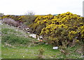
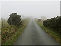
Photos of LL15 2DS

Area Information
LL15 2DS is a small, low-density residential cluster in north Wales, covering just 1.0 km² and home to 1798 people. Its sparse population density of 17 people per square kilometre suggests a quiet, perhaps rural or semi-rural character, with homes spread out rather than clustered in high-rise or dense urban layouts. This area likely offers a slower pace of life compared to larger towns, with fewer crowds and more open space. While no major cities or transport hubs are mentioned, the proximity to retail outlets like Aldi Ruthin and Co-op Ruthin indicates access to essential services. The area’s small size means it is likely self-contained, with daily life revolving around local amenities and nearby natural landscapes. Given the lack of data on nearby parks or recreational areas, it is unclear whether the area offers significant green space, but the absence of environmental constraints like AONB or Ramsar sites suggests minimal restrictions on development or land use. For buyers seeking a peaceful, low-density environment, LL15 2DS may appeal, though its limited size means it is best suited to those prioritising tranquillity over proximity to larger urban centres.
- Area Type
- Postcode
- Area Size
- 1.0 km²
- Population
- 1798
- Population Density
- 17 people/km²
LL15 2DS is predominantly an owner-occupied area, with 77% of homes owned by residents rather than rented. The accommodation type is exclusively houses, which is unusual for a small postcode area and may indicate a focus on family homes or larger properties. This suggests a housing stock that is likely older, with fewer apartments or flats, and potentially higher value properties compared to more densely populated areas. The low population density of 17 people per square kilometre further supports this, as houses typically require more space than other housing types. For buyers, this means the market may be limited in size, with fewer properties available than in larger towns. However, the high home ownership rate could indicate strong demand from existing residents, potentially leading to competitive pricing. Those considering the area should note that the small size of LL15 2DS may require looking beyond immediate surroundings for more options, though the presence of nearby retail and schools suggests some local infrastructure to support homeownership.
House Prices in LL15 2DS
Showing 11 properties
Energy Efficiency in LL15 2DS
Residents of LL15 2DS have access to a handful of retail outlets within practical reach, including Aldi Ruthin, Morrisons Daily, and Co-op Ruthin. These stores provide essential shopping options for groceries, household items, and everyday necessities, reducing the need for long commutes to larger towns. The specific names of these venues suggest a mix of national chains and local stores, which may contribute to a familiar, convenient shopping experience. While no parks, leisure facilities, or dining options are listed in the data, the presence of multiple retail points indicates a focus on practicality and local service. The low population density implies that the area may not have large-scale entertainment or recreational spaces, but the availability of nearby shops could support a self-sufficient lifestyle. For those valuing convenience and proximity to basic amenities, LL15 2DS offers a functional, if modest, selection of venues.
Amenities
Schools
The area is served by three schools: Ysgol Cyffylliog, Ysgol Bro Cinmeirch, and Ysgol Pant Pastynog. All are categorised as 'other' in the data, which may indicate they are not state-funded primary or secondary schools but could include sixth-form colleges, specialist institutions, or schools with unique educational focuses. While no Ofsted ratings are provided, the presence of multiple schools suggests a range of educational options for families. However, the lack of specific details on school types or performance means it is unclear whether these institutions cater to early years, secondary education, or vocational training. For families prioritising school quality, further research would be needed to determine the suitability of these institutions. The mix of schools may offer flexibility, but without additional data on curriculum, student outcomes, or accessibility, prospective buyers must rely on local reputation or direct inquiries to assess their value.
| Rank | School | Type | Entry gender | Ages |
|---|
Explore more schools in this area
Go to Schools tabDemographics
The population of LL15 2DS skews towards adults aged 30–64, with a median age of 47. This suggests a community of middle-aged residents, possibly including families and professionals in their prime working years. Home ownership is high at 77%, indicating a stable, long-term resident base rather than a transient rental market. The predominant accommodation type is houses, which aligns with the low population density and suggests a mix of family homes and perhaps larger properties. The ethnic composition is overwhelmingly White, with no data provided on other groups. This demographic profile implies a cohesive, established community with fewer cultural or generational divides. However, the absence of data on deprivation or income levels means it is unclear whether the area faces socioeconomic challenges. The age range and home ownership rate suggest a mature, settled population, which could influence local services and amenities, such as schools and healthcare, to cater to adult and family needs rather than younger demographics.
Household Size
Accommodation Type
Tenure
Ethnic Group
Religion
Household Composition
Age
Household Deprivation
NS-SEC
Explore more demographic insights in this area
Go to Demographics tabPlanning
Planning Constraints
- Flood RiskPremium
- Ramsar Wetland SitesPremium
- Area of Outstanding Natural BeautyPremium
- Protected Nature ReservePremium
- Protected WoodlandPremium
- Crime RiskPremium