Area Overview for Ruthin Community
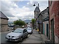
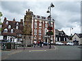
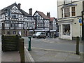
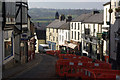
Photos of Ruthin Community
Area Information
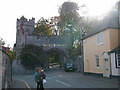
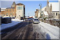
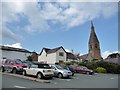
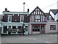
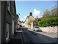
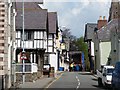
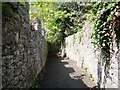
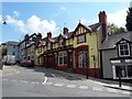
Living in Ruthin Community offers a defined rural experience within a civil parish in Wales. The area covers 8.2 km², which creates a compact yet distinct neighbourhood character. You will find yourself in a setting where the landscape and local infrastructure are tightly woven together. This is a location where residents value the established nature of their local surroundings. Daily life here revolves around the specific boundaries of this parish and the amenities accessible within them. The community sits apart from the more rapid growth found in larger urban centres. Instead, it presents a quieter alternative for those seeking a specific type of rural residency. The distinctiveness of the area comes from its classification as a civil parish, which often implies a stronger sense of local governance and community identity. You are navigating an environment where the physical footprint is relatively small compared to larger towns. This size can make local services feel more reachable while maintaining a village-scale atmosphere. The area represents a specific slice of the Welsh countryside available for purchase and residence. Prospective homebuyers here are entering a market defined by these precise geographical boundaries. The daily rhythm of Ruthin Community is set by its own internal logic rather than being driven by the demands of a larger city.
- Area Type
- Parish
- Area Size
- 8.2 km²
- Population
- Not available
- Population Density
- Not available
Demographics
The people living in Ruthin Community define the character of this rural parish. The median age stands at 70, meaning the typical resident in the area is significantly older than the national average. This statistic reveals a community dominated by older generations rather than young families or students. Most common age data suggests the population skews heavily towards this mature demographic. With a median age of 70, you are looking at an area where retirement and established living prevail. Household compositions reflect this stability, as younger adults often move away after careers or education. Home ownership levels are notably high at 66% across the community. This figure indicates that two out of every three households are owned outright or with a mortgage, rather than being private rentals. Such a high ownership rate typically signals long-term stability within the local population. Residents here have likely put down roots over many decades rather than staying for a few years. This stability reduces tenant turnover and creates a settled neighbourly environment. The accommodation types available mirror this ownership trend, favouring standard family houses or flats suited to retirees. While specific data on ethnicity and religion is not detailed in available records, the demographic profile is clear.
Household Size
Accommodation Type
Tenure
Ethnic Group
Religion
Household Composition
Age
Household Deprivation
NS-SEC
Explore more demographic insights in this area
Go to Demographics tabPlanning
Planning Constraints
- Flood RiskPremium
- Ramsar Wetland SitesPremium
- Area of Outstanding Natural BeautyPremium
- Protected Nature ReservePremium
- Protected WoodlandPremium
- Crime RiskPremium